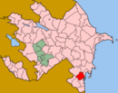
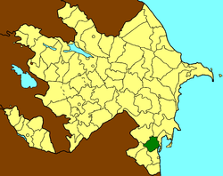
Masally District
| Masally Masallı | |
|---|---|
 | |
| Coordinates: 39°02′N 48°39′E / 39.033°N 48.650°ECoordinates: 39°02′N 48°39′E / 39.033°N 48.650°E | |
| Country |
|
| Area | |
| • Total | 721 km2 (278 sq mi) |
| Population (2005) | |
| • Total | 184 900 |
| • Density | 158/km2 (410/sq mi) |
| Time zone | GMT+4 (UTC+4) |
| • Summer (DST) | GMT+5 (UTC+5) |
Masally (Masallı) is the administrative area in the south of Azerbaijan
Geography
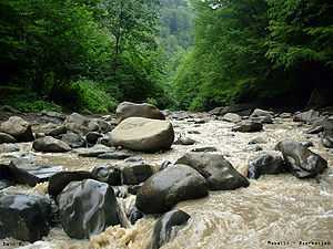
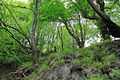
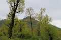
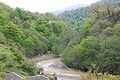
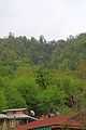
This territory borders on Lankaran, Lerik, Yardimli, Jalilabad, Neftchala districts. In the east, the district is washed by the Caspian Sea, and in the west it approaches Talish mountains, Burovar ridge. Height of the territory reaches 917 m. There are mineral and geothermal springs in Masally.[1] Average temperature is 2,5°C in January, and 25,6°C in July. The amount of annual precipitation is 600–800 mm. Vilash is the largest river of the district. There are broad-leaved forests of Girkan type-chestnut-leaved oak, hornbeam, beech, Persian ironwood tree, Girkan boxwood, Caucasian persimmon, medlar and others in the mountainous part of the district. Total area of the district's forests equals to 16,9 thousand ha.
History
Masally rayon was originated in 1930. Formerly, the territory of the district was the part of Arkevan area of Lankaran rayon.
State political system
The head of Masally rayon is chief executive. Chief executives:
- Safarov Azer Fattah oglu-till September 30, 2004]
- Aliyev Ogtay Jalil oglu-from September 30, 2004 to September 29, 2006
- Agayev Gazanfar Arif oglu-since September 30, 2006[2]
Administrative structure
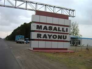
The center of the district is city Masally. Average population density is 158 people per km². Boradigah township, Badalan, Arkevan, Banbashi, Gizilagaj, Teze Alvadi villages are the other largest population aggregates.
Photos
References
- ↑ "Masally Travel Guide". April 28, 2006.
- ↑ "Президент Азербайджана усилил исполнительную власть в Масаллинском районе". 29 September 2006.
|