Marysvale volcanic field
| Marysvale volcanic field | |
|---|---|
 Indian Peak caldera complex, and Caliente, Three Creeks, Mount Belknap, Big John and Monroe Peak calderas. | |
| Location | |
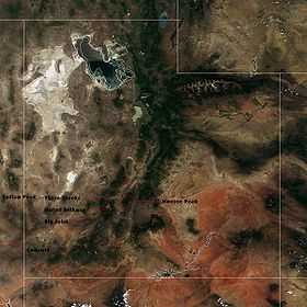
 Marysvale volcanic field Utah | |
| Location | Utah, United States |
| Coordinates | 38°30′N 112°30′W / 38.500°N 112.500°WCoordinates: 38°30′N 112°30′W / 38.500°N 112.500°W |
| Geology | |
| Type | Volcanic field |
| Age of rock | Middle Cenozoic |
The Marysvale volcanic field is located in southwestern Utah, United States.
One of the largest volcanic fields in the western United States, the Marysvale straddles the Colorado Plateau-Great Basin transition zone. Most igneous rocks belong to a middle Cenozoic (~32 to 22 million years old) calc-alkaline sequence, although about 5% are related to an upper Cenozoic (23 million years to Holocene) bimodal (basalt and rhyolite) sequence. The Marysvale contains a variety of volcanic features, including stratovolcanoes, calderas, lava domes, and cinder cones.
The field is an example of intraplate volcanism; its earlier deposits are thought to be related to Farallon plate subduction, while the later bimodal assemblage (especially the basalts) have been linked to Basin and Range extension.
Notable calderas
| Name | Size | Coordinates | Age |
| Monroe Peak Caldera | 20 x 16 km | 38°29′00″N 112°03′30″W / 38.483333°N 112.058333°W[1] | 23 Ma |
| Big John Caldera | 10 x 6 km | 38°19′06″N 112°23′00″W / 38.318225°N 112.383333°W[1] | 24 Ma |
| Mount Belknap Caldera | 17 x 13 km | 38°26′51″N 112°30′00″W / 38.4475°N 112.5°W[1] | 19 Ma |
See also
- Geology of the Bryce Canyon area
- Large volume volcanic eruptions in the Basin and Range Province
- Tushar Mountains, Delano Peak
References
- ↑ 1.0 1.1 1.2 Rowley, Peter D.; Cunningham, Charles G.; Steven, Thomas A.; Workman, Jeremiah B.; Anderson, John J.; Theissen, Kevin M. (2002). Geologic Map of the Central Marysvale Volcanic Field, Southwestern Utah: U.S. Geological Survey Geologic Investigations Series I-2645-A. Denver, Colorado: U. S. Geological Survey. Retrieved 2010-05-02.
- Peter D. Rowley, Charles G. Cunningham, John J. Anderson, Thomas A. Steven, Jeremiah B. Workman, and Lawrence W. Snee (May 6, 2002), "Geology and Mineral Resources of the Marysvale Volcanic Field, Southwestern Utah", in Lund, W.R., Field Guide to Geologic Excursions in Southwestern Utah and Adjacent Areas of Arizona and Nevada, Geological Society of America 2002 Rocky Mountain Section Annual Meeting, Cedar City, Utah: US Geological Survey Open-File Report 02–172