Marotiri
 Marotiri or Bass Rocks | |
 | |
| Geography | |
|---|---|
| Location | Pacific Ocean |
| Coordinates | 27°55′S 143°26′W / 27.917°S 143.433°W |
| Archipelago | Australes |
| Total islands | 4 |
| Area | 0.0431 km2 (0.0166 sq mi) |
| Highest elevation | 113 m (371 ft) |
| Highest point | Southern Rock |
| Country | |
|
France | |
| Overseas collectivity | French Polynesia |
| Administrative subdivision | Austral Islands |
| Commune | Rapa Iti |
| Demographics | |
| Population | Uninhabited[1] (as of 2012) |
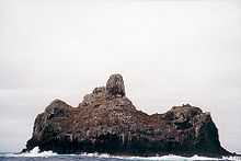
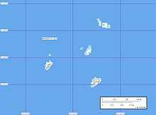
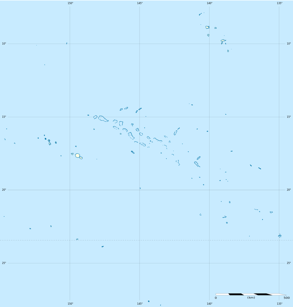
Marotiri is a group of four uninhabited volcanic rocks protruding from the sea (and several submerged rocks), forming the southeastern end of the Austral Islands of French Polynesia. Marotiri is also known as Bass Rocks (Îlots de Bass in French),[2] maybe according to the name of the European explorer George Bass. Marotiri is very isolated,[3] located about 1,167 km (725 mi) west-south-westward of Pitcairn Island.[4] The closest island is Rapa Iti, 75 km farther northwest, but separated from it by an ocean depth of more than 1,500 meters.[5] The rocks are part of the municipality of Rapa.
The climate is wet temperate. The rocks are almost devoid of vegetation.[4] They are important as a seabird rookery. The waters around the rocks abound in fish. The rocks emerge from a submarine platform 100 meters deep and 5 km in diameter. They lie at a distance between 1.5 and 3 km from one another. The total land area is 43,100 m², which is broken down as follows by the individual rocks:
| Rock | Area (m²) |
|---|---|
| Northern Rock | 5,800 |
| Central Rock | 1,800 |
| Southern Rock | 22,400 |
| Western Rock | 13,100 |
| Marotiri | 43,100 |
The southern rock is the largest, with a height of 113 meters at its highest point.
References
- ↑ "Population". Institut de la statistique de la Polynésie française. Retrieved 10 January 2015.
- ↑ According to the French hydrographic office (SHOM) nautical charts 6607 and 4232.
- ↑ International Association of Biological Oceanographers. Committee on Coral Reefs (1985). Proceedings of the Fifth International Coral Reef Congress: Symposia and seminars (B). Antenne Museum--EPHE. p. 90. ISBN 978-2-905630-03-2. Retrieved 22 July 2012.
- ↑ 4.0 4.1 Pacific islands pilot. Sold by J.D. Potter. 1969. p. 61. Retrieved 22 July 2012.
- ↑ According to the French hydrographic office (SHOM) nautical charts 6607, there is a depth of 1,646 meters midway between Rapa and Marotiri.