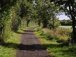
Marland Works railway station
| Marland Works | |
|---|---|
|
Trackbed of the old line. | |
| Location | |
| Place | Peters Marland Ball clay works |
| Area | Torridge |
| Grid reference | SS507118 |
| Operations | |
| Pre-grouping |
Torrington and Marland Railway(1881 -1925) North Devon and Cornwall Junction Light Railway (1925 to 1948)[1] |
| Post-grouping | Southern Region of British Railways (1948 to 1966) |
| Platforms | One |
| History | |
| 27 July 1925 | Opened |
| 27 January 1981 | Closed |
| Disused railway stations in the United Kingdom | |
|
Closed railway stations in Britain A B C D–F G H–J K–L M–O P–R S T–V W–Z | |
| UK Railways portal | |
Marlands Works was a busy industrial site for just over a century,[2] firstly on the Torrington and Marland Railway,[3] built to carry bricks and clay on a three-feet gauge, which in turn was subsumed in 1925 by the North Devon and Cornwall Junction Light Railway[4] before finally becoming part of the Southern Region of British Railways in 1948.[5] The line closed to passenger traffic in 1965[6] as part of the Beeching [7] reforms but the line remained open for freight between Barnstaple railway station and Torrington until 1982.[8] Today it forms part of the popular Tarka trail, although an important site for industrial railway historians[9] too. Marland Works station was used by workmen only and was not in public passenger use.
References
- ↑ Private, not grouped in 1923
- ↑ History of Clay web-site Photographer’s research
- ↑ North Devon Clay Messenger,M: Truro, Twelveheads Press, 1982 ISBN 0-906294-06-1
- ↑ Collation of sources, Devon railways
- ↑ Branch Lines to Torrington Mitchell,V/Smith,K: Midhurst, Middleton Press,1994 ISBN 1-873793-37-5
- ↑ "Discovering Britain's lost railways" Atterbury,P: Basingstoke, AA Publishing ISBN 978-0-7495-6370-7
- ↑ Detailed closure schedules
- ↑ Freight details
- ↑ IR archives
| Preceding station | Disused railways | Following station | ||
|---|---|---|---|---|
| Dunsbear | Torrington and Marland Railway (1881-1925) North Devon and Cornwall Junction Light Railway (1925 to 1948) Southern Region of British Railways (1948 to 1966) |
Petrockstow | ||
See also
| ||||||
Coordinates: 50°53′30″N 4°07′53″W / 50.8918°N 4.1315°W
