Marion Forks, Oregon
| Marion Forks | |
|---|---|
| Unincorporated community | |
|
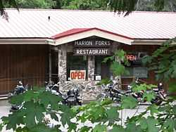
Marion Forks Restaurant | |
 Marion Forks Location within the state of Oregon | |
| Coordinates: 44°36′56″N 121°56′49″W / 44.61556°N 121.94694°WCoordinates: 44°36′56″N 121°56′49″W / 44.61556°N 121.94694°W | |
| Country | United States |
| State | Oregon |
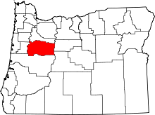
| County | Linn |
| Elevation | 2,438 ft (743 m) |
| Time zone | Pacific (PST) (UTC-8) |
| • Summer (DST) | PDT (UTC-7) |
| ZIP code | 97350 |
| Area code(s) | 503 and 971 |
| GNIS feature ID | 1145812 |
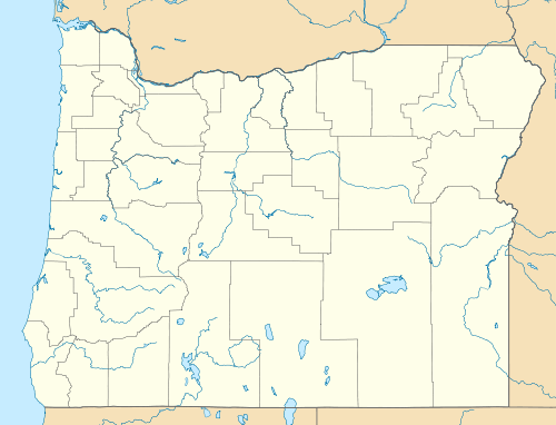
Marion Forks is an unincorporated community on the North Santiam Highway, 15 miles (24 km) south of the city of Detroit, in Linn County, Oregon, United States.
The community is named for the nearby river fork where Marion Creek is received by the North Santiam River at the latter's river mile 86, the point at which Detroit Reservoir affects the level of the North Santiam River. Marion Creek was formerly known as the Marion Fork Santiam River.[1][2]
Marion Forks is served by the Santiam Canyon School District.[3] The Oregon Department of Fish and Wildlife Marion Forks fish hatchery is south of the community,[4] and the Willamette National Forest Marion Forks Campground is near the hatchery, next to Marion Creek.[5]
There are two National Register of Historic Places-listed structures in the Marion Forks area: Independence Prairie Ranger Station and Marion Forks Guard Station.
References
- ↑ McArthur, Lewis A.; McArthur, Lewis L. (2003) [First published 1928]. Oregon Geographic Names (7th ed.). Portland, Oregon: Oregon Historical Society Press. p. 610. ISBN 9780875952772. OCLC 53075956.
- ↑ U.S. Geological Survey Geographic Names Information System: Marion Creek
- ↑ Santiam Canyon School District
- ↑ The ODFW Visitors' Guide: Northwest Region: Marion Forks Hatchery
- ↑ Willamette National Forest: Marion Forks Campground
External links
- Marion Forks Snotel Site #614 United States Department of Agriculture Natural Resources Conservation Service
- U.S. Geological Survey Geographic Names Information System: Marion Forks, Oregon
| |||||||||||||||||||||||||