Marihatag, Surigao del Sur
| Marihatag | |
|---|---|
| Municipality | |
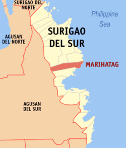 Map of Surigao del Sur with Marihatag highlighted | |
.svg.png) Marihatag Location within the Philippines | |
| Coordinates: 08°48′N 126°18′E / 8.800°N 126.300°ECoordinates: 08°48′N 126°18′E / 8.800°N 126.300°E | |
| Country | Philippines |
| Region | Caraga (Region XIII) |
| Province | Surigao del Sur |
| District | 1st district of Surigao del Sur |
| Barangays | 12 |
| Government[1] | |
| • Mayor | Alan A. Pelenio |
| Area[2] | |
| • Total | 312.50 km2 (120.66 sq mi) |
| Population (2010)[3] | |
| • Total | 17,926 |
| • Density | 57/km2 (150/sq mi) |
| Time zone | PST (UTC+8) |
| ZIP code | 8306 |
| Dialing code | 86 |
| Income class | 3rd |
Marihatag (known as Oteiza until 1955[4])is a third class municipality in the province of Surigao del Sur, Philippines. According to the 2010 census, it has a population of 17,926 people.[3]
The municipality hosts the "Balik-Marihatag" Festival which literally means going back home to Marihatag.
Etymology
Its name is a concatenation of Maria Ihatag.
Barangays
Marihatag is politically subdivided into 12 barangays.[2]
- Alegria
- Amontay
- Antipolo
- Arorogan
- Bayan
- Mahaba
- Mararag
- Poblacion
- San Antonio
- San Isidro
- San Pedro
- Sta Cruz
Demographics
| Population census of Marihatag | ||
|---|---|---|
| Year | Pop. | ±% p.a. |
| 1990 | 10,663 | — |
| 1995 | 13,254 | +4.16% |
| 2000 | 16,394 | +4.66% |
| 2007 | 17,622 | +1.00% |
| 2010 | 17,926 | +0.62% |
| Source: National Statistics Office[3] | ||
See also
- List of renamed cities and municipalities in the Philippines
References
- ↑ "Official City/Municipal 2013 Election Results". Intramuros, Manila, Philippines: Commission on Elections (COMELEC). 1 July 2013. Retrieved 5 September 2013.
- ↑ 2.0 2.1 "Province: SURIGAO DEL SUR". PSGC Interactive. Makati City, Philippines: National Statistical Coordination Board. Retrieved 1 April 2014.
- ↑ 3.0 3.1 3.2 "Total Population by Province, City, Municipality and Barangay: as of May 1, 2010". 2010 Census of Population and Housing. National Statistics Office. Retrieved 1 April 2014.
- ↑ Republic Act No. 1261, PhilippineLaw.info, retrieved 2012
External links
- Philippine Standard Geographic Code
- Philippine Census Information
- Local Governance Performance Management System
 |
San Miguel | Tago / Cagwait | | |
| Prosperidad, Agusan del Sur | |
Philippine Sea | ||
| ||||
| | ||||
| San Agustin |
| ||||||||||||||