Mariental, Namibia
| Mariental | ||
|---|---|---|
| City | ||
| ||
| Nickname(s): Stofbakkies | ||
| Motto: Luceat et crescat | ||
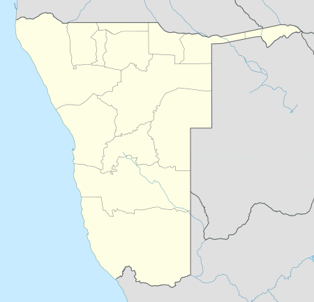 Mariental Location in Namibia | ||
| Coordinates: 24°38′S 17°58′E / 24.633°S 17.967°E | ||
| Country |
| |
| Region | Hardap Region | |
| Government | ||
| Elevation | 3,580 ft (1,090 m) | |
| Population (2011)[1] | ||
| • Total | 12,478 | |
| Time zone | West Africa Time (UTC+1) | |
| • Summer (DST) | Central Africa Time (UTC+2) | |

Mariental is a city[2] of 10,000 inhabitants in south-central Namibia, lying on the B1 national road 145 miles (232 km) north of Keetmanshoop and 170 miles (274 km) southeast of Windhoek. It lies at an elevation of 3,576 feet (1,090 metres). Mariental is connected to the TransNamib railway line from Windhoek to Keetmanshoop. The town and the surrounding area are in a hot, arid region.[3] Mariental is the administrative capital of the Hardap Region in an area which has long been a centre for the Nama people. It lies near the Hardap Dam, the largest reservoir in Namibia.
History
Named by local Rhenish (German Lutheran) missionaries, the town was founded in 1912 as a railway stop between Windhoek and Keetmanshoop and named after Maria, the wife of the first colonial settler of the area, Hermann Brandt.[4] It was proclaimed a town in 1920 and a municipality in 1946. Mariental is home to a large number of Nama-speaking people, descendants of the early Khoi inhabitants of Namibia. The people of Mariental are known for their big smiles and hospitality.
The Fish River which flows in a southerly direction past the town caused severe flooding in the western side of the town on a number of occasions, most recently after persistent rain during February 2006 when the Hardap Dam's sluices had to be opened and severe flooding occurred on the weekend of 25–26 February 2006.
Since Hardap Dam was built in 1962 floods also have taken place in 1972 and twice in 2000 with previous floods (before the dam was built) recorded in 1923 and 1934.
Geography
Climate
Mariental has a desert climate (BWh, according to the Köppen climate classification), with hot summers and cool winters (with mild days and chilly nights). The average annual precipitation is 194 mm (8 in).
| Mariental | ||||||||||||||||||||||||||||||||||||||||||||||||||||||||||||
|---|---|---|---|---|---|---|---|---|---|---|---|---|---|---|---|---|---|---|---|---|---|---|---|---|---|---|---|---|---|---|---|---|---|---|---|---|---|---|---|---|---|---|---|---|---|---|---|---|---|---|---|---|---|---|---|---|---|---|---|---|
| Climate chart (explanation) | ||||||||||||||||||||||||||||||||||||||||||||||||||||||||||||
| ||||||||||||||||||||||||||||||||||||||||||||||||||||||||||||
| ||||||||||||||||||||||||||||||||||||||||||||||||||||||||||||
Economy
The nearby Hardap Dam is the largest reservoir in Namibia and provides water for irrigation, making possible to cultivate animal fodder, as well as corn, fruits and vegetables. The town is surrounded by flourishing commercial farms which, due to the low annual rainfall in the area focus on game farming as well as sheep and ostrich farming which along with cattle farming remain popular in the region. Export grapes, cotton lucern and dairy farming is also sustained by irrigation from the Hardap Dam.
A local ostrich abattoir used to cater for this increasingly important industry, but recently went bankrupt, and what survives of the karakul trade in the south is centered around Mariental. Sitting astride the main route into the Kalahari and Namib Deserts, Mariental also services the needs of farmers in these areas. Mariental also boasts some of the best safari and hunting experiences in Namibia at lodges like Lapa Lange and Anib Lodge. Available game include springbuck, blesbuck, giraffe, ostrich, leopard, zebra, kudu, gemsbuck, hartebeest, eland, blue- and black wildebeest.
The German association “Fahrräder für Afrika e.V.” (Bicycles for Africa) has built a “Bicycle Empowerment Centre” in the town together with the Catholic Aids Action (CAA) and the Bicycling Empowerment Network (BEN) Namibia. Local people infected with the HI-virus were trained to repair and build bikes and also received the know-how to run the workshop on their own. Second-hand Bicycles are being sold at low prices to the inhabitants of the region, allowing easy travel and transportation, while the income from the workshops is also used to finance local aid projects. The project is supported by governmental agencies in Germany and Namibia.[5]
Hardap dam
The Hardap Dam.[6] on the Fish River 22 km northwest of Mariental is the biggest dam in Namibia with a water surface of about 25 sqkms, a capacity of 320 million m3 and an 86.2 metre long dam wall. The dam has been developed as a popular watersport and holiday resort for tourists, campers, water-skiers and anglers. The dam is Namibia’s first large earth-fill dam and supplies water to the area
References
- ↑ "Table 4.2.2 Urban population by Census years (2001 and 2011)". Namibia 2011 - Population and Housing Census Main Report. Namibia Statistics Agency. p. 39. Retrieved 10 September 2013.
- ↑ "Local Authorities". Association of Local Authorities in Namibia (ALAN). Retrieved 1 October 2012.
- ↑ http://www.britannica.com/EBchecked/topic/365141/Mariental
- ↑ http://www.findagrave.com/cgi-bin/fg.cgi?page=gr&GRid=61919998
- ↑ German site of Fahrräder für Afrika e.V.
- ↑ http://www.namibia-1on1.com/mariental.html