Marian-glas
| Marian-glas | |
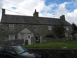 Henefail Cottages in Marian-glas |
|
 Marian-glas |
|
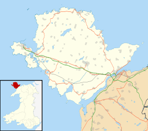
| OS grid reference | SH503843 |
|---|---|
| Community | Llaneugrad |
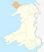
| Principal area | Anglesey |
| Ceremonial county | Gwynedd |
| Country | Wales |
| Sovereign state | United Kingdom |
| Post town | MARIANGLAS |
| Postcode district | LL73 |
| Dialling code | 01248 |
| Police | North Wales |
| Fire | North Wales |
| Ambulance | Welsh |
| EU Parliament | Wales |
| UK Parliament | Ynys Môn |
| Welsh Assembly | Ynys Môn |
Coordinates: 53°20′05″N 4°14′52″W / 53.3346°N 4.2478°W
Marian-glas or Marianglas is a small village and post town in Anglesey, in north-west Wales.[1] It is situated between the larger villages of Moelfre and Benllech and just off the A5025. There is a large caravan park on the edge of the village and several camp sites. However there is no church, pub or shop. It has a memorial to those killed in the two world wars, including a list of 17 seamen from the Merchant Navy.[2]
Marian-glas Hut Group is an unenclosed hut circle (53°20′16″N 4°15′06″W / 53.3379°N 4.2516°W, SH501846). This Scheduled Ancient Monument (Cadw SAM No. AN093) is a roundhouse settlement dating at least back to Roman times. It is also called Cae Marh Hut Group. There are several huts with thick walls, some standing up to 1.4m high.[3][4] Some of the huts walls are now obscured by a thicket, while others are visible as wall lines in the lawns of Marianglas caravan park. The location is indicated on the ground through a signboard by the Ministry of Public Building and Works (which dates the sign to 1962-70).[5]
Gallery
-

Marian-glas Hut Group and Ministry of Works sign
-

Yr Hen Ysgol - a former school building facing the green at Marian-Glas
References
- ↑ Google Maps (Map). Google.
- ↑ "Marianglas War Memorials on the Isle of Anglesey". Anglesey.info. Retrieved 2013-09-02.
- ↑ Coflein NPRN No.302509, RCAHMW .
- ↑ Archwilio: Gwynneth Archaeological Trust PRN No 3611.
- ↑ "Records of the successive Works departments, and the Ancient Monuments Boards and... | The National Archives". Discovery.nationalarchives.gov.uk. Retrieved 2013-09-02.
| ||||||||||||||||||||||||||||