Marguerittes
| Marguerittes | ||
|---|---|---|
| ||
 Marguerittes | ||
|
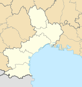
Location within Languedoc-Roussillon region  Marguerittes | ||
| Coordinates: 43°51′39″N 4°26′41″E / 43.8608°N 4.4447°ECoordinates: 43°51′39″N 4°26′41″E / 43.8608°N 4.4447°E | ||
| Country | France | |
| Region | Languedoc-Roussillon | |
| Department | Gard | |
| Arrondissement | Nîmes | |
| Canton | Marguerittes | |
| Intercommunality | Nîmes Métropole | |
| Government | ||
| • Mayor (2008–2014) | William Portal | |
| Area1 | 25.29 km2 (9.76 sq mi) | |
| Population (2008)2 | 8,671 | |
| • Density | 340/km2 (890/sq mi) | |
| INSEE/Postal code | 30156 / 30320 | |
| Elevation |
41–197 m (135–646 ft) (avg. 51 m or 167 ft) | |
|
1 French Land Register data, which excludes lakes, ponds, glaciers > 1 km² (0.386 sq mi or 247 acres) and river estuaries. 2 Population without double counting: residents of multiple communes (e.g., students and military personnel) only counted once. | ||
Marguerittes is a commune in the Gard department in southern France. In 1717, Antoine de Teissier (b.1667) was created the 1st Baron de Margeurittes. One of his sons was a Huguenot who took refuge in Switzerland and his grandson, Jean Antoine de Teissier, 3rd Baron of Marguerittes, was guillotined 20 May, 1794. The 3rd Baron's son settled in England at Woodcote Park and was created Baron de Teissier by Louis XVIII in recognition of his father's sacrifices to France.
Population
| Historical population | ||
|---|---|---|
| Year | Pop. | ±% |
| 1793 | 2,103 | — |
| 1800 | 1,945 | −7.5% |
| 1806 | 2,305 | +18.5% |
| 1821 | 1,812 | −21.4% |
| 1831 | 1,925 | +6.2% |
| 1836 | 1,910 | −0.8% |
| 1841 | 1,886 | −1.3% |
| 1846 | 1,908 | +1.2% |
| 1851 | 1,972 | +3.4% |
| 1856 | 2,013 | +2.1% |
| 1861 | 2,037 | +1.2% |
| 1866 | 1,945 | −4.5% |
| 1872 | 1,889 | −2.9% |
| 1876 | 1,971 | +4.3% |
| 1881 | 1,905 | −3.3% |
| 1886 | 1,755 | −7.9% |
| 1891 | 1,684 | −4.0% |
| 1896 | 1,724 | +2.4% |
| 1901 | 1,637 | −5.0% |
| 1906 | 1,580 | −3.5% |
| 1911 | 1,519 | −3.9% |
| 1921 | 1,514 | −0.3% |
| 1926 | 1,529 | +1.0% |
| 1931 | 1,528 | −0.1% |
| 1936 | 1,447 | −5.3% |
| 1946 | 1,421 | −1.8% |
| 1954 | 1,678 | +18.1% |
| 1962 | 2,030 | +21.0% |
| 1968 | 2,548 | +25.5% |
| 1975 | 3,150 | +23.6% |
| 1982 | 5,149 | +63.5% |
| 1990 | 7,548 | +46.6% |
| 1999 | 8,181 | +8.4% |
| 2008 | 8,671 | +6.0% |
See also
References
| Wikimedia Commons has media related to Marguerittes. |
.svg.png)