Mareeba
| Mareeba Queensland | |||||||
|---|---|---|---|---|---|---|---|
 | |||||||
 Mareeba | |||||||
| Coordinates | 16°59′0″S 145°25′0″E / 16.98333°S 145.41667°ECoordinates: 16°59′0″S 145°25′0″E / 16.98333°S 145.41667°E | ||||||
| Population | 6,806 (2006 census)[1] | ||||||
| Established | 1877 | ||||||
| Postcode(s) | 4880 | ||||||
| Elevation | 400 m (1,312 ft) | ||||||
| LGA(s) | Shire of Mareeba | ||||||
| State electorate(s) | Cook | ||||||
| Federal Division(s) | Kennedy | ||||||
| |||||||
Mareeba /məˈriːbə/[2] is a town on the Atherton Tableland in Far North Queensland, Australia. The town is 417 metres (1,368 ft) above sea level on the confluence of the Barron River, Granite Creek and Emerald Creek. It is within the local government area of Shire of Mareeba (between 2008 and 2013, it was within the Tablelands Region). The town's name is derived from an Aboriginal word meaning meeting of the waters.[3] At the 2006 census, Mareeba had a population of 6,806.[1]
History
Prior to European settlement, the area around Mareeba was inhabited by the Muluridji people. They maintained a hunter/gatherer existence in the area between Mount Carbine, Mareeba, Rumula and Woodville, mainly concentrated between Bibhoora and Mount Molloy. In the local Aboriginal language, Mareeba means meeting of the waters - referring to the point at which the Barron River is joined by Granite Creek.
On 26 May 1875 James Venture Mulligan became the first European officially to see the future site of Mareeba when he rode up the eastern bank of the Barron River, and passed the junctions of Emerald Creek and Granite Creek.
The Mareeba area was first settled by Europeans in 1877 by John Atherton, who arrived with cattle at Emerald End, which is just north of the town today. Mareeba quickly became a busy coach stop for Cobb & Co on the road from Port Douglas to Herberton. When the railway arrived in 1893, Mareeba grew into a busy town.
Mareeba Post Office opened on 25 August 1893 (a receiving office named Granite Creek had been open from 1891). A Mareeba Diggings Post Office opened by 1893 and closed in 1905.[4]
From 1942 to 1945, up to 10,000 Australian and US service personnel used Mareeba Airfield as a staging post for battles in New Guinea and the Pacific. The Americans referred to it as Hoevet Field in honour of Major Dean Carol "Pinky" Hoevet who was killed on 16 August 1942. Units that were based at Mareeba during World War II included No. 5 Squadron RAAF, No. 100 Squadron RAAF, the Australian 33rd Light A-A Battery, 19th Bomb Group USAAC, 43rd Bomb Group USAAC and 8th Fighter Group USAAC.
Heritage listings
Mareeba has a number of heritage-listed sites, including:
- Cairns - Kuranda Line: Rail Bridge over Christmas Creek[5]
- Mareeba Mining District: Tyrconnel Mine and Battery[6]
- 136 Walsh Street: Mareeba Shire Hall[7]
- 167 Walsh Street: Assay Office & Store, Mareeba[8]
Climate
Mareeba has a tropical savanna climate, bordering on humid subtropical climate.
| Climate data for Mareeba (1952-2008) | |||||||||||||
|---|---|---|---|---|---|---|---|---|---|---|---|---|---|
| Month | Jan | Feb | Mar | Apr | May | Jun | Jul | Aug | Sep | Oct | Nov | Dec | Year |
| Record high °C (°F) | 37.8 (100) |
37.8 (100) |
36.0 (96.8) |
33.9 (93) |
34.1 (93.4) |
30.6 (87.1) |
34.9 (94.8) |
33.3 (91.9) |
36.2 (97.2) |
40.5 (104.9) |
40.6 (105.1) |
37.8 (100) |
40.5 (104.9) |
| Average high °C (°F) | 31.3 (88.3) |
30.8 (87.4) |
29.8 (85.6) |
28.6 (83.5) |
27.0 (80.6) |
25.7 (78.3) |
25.3 (77.5) |
26.6 (79.9) |
28.1 (82.6) |
30.5 (86.9) |
32.1 (89.8) |
32.0 (89.6) |
29.0 (84.2) |
| Average low °C (°F) | 20.9 (69.6) |
21.2 (70.2) |
20.0 (68) |
17.8 (64) |
15.4 (59.7) |
12.3 (54.1) |
11.2 (52.2) |
11.7 (53.1) |
13.5 (56.3) |
15.9 (60.6) |
18.7 (65.7) |
20.2 (68.4) |
16.6 (61.9) |
| Record low °C (°F) | 11.1 (52) |
14.7 (58.5) |
13.9 (57) |
10.4 (50.7) |
1.7 (35.1) |
0.4 (32.7) |
0.7 (33.3) |
1.7 (35.1) |
5.4 (41.7) |
7.0 (44.6) |
7.0 (44.6) |
11.5 (52.7) |
0.4 (32.7) |
| Average rainfall mm (inches) | 200.0 (7.874) |
249.8 (9.835) |
191.8 (7.551) |
46.6 (1.835) |
22.2 (0.874) |
14.7 (0.579) |
7.1 (0.28) |
6.8 (0.268) |
5.3 (0.209) |
14.3 (0.563) |
52.2 (2.055) |
104.5 (4.114) |
915.3 (36.037) |
| Avg. rainy days (≥ 0.2mm) | 15.0 | 16.1 | 14.5 | 10.4 | 7.0 | 5.0 | 3.6 | 3.3 | 2.2 | 3.2 | 6.2 | 9.4 | 95.9 |
| Source: Bureau of Meteorology[9] | |||||||||||||
Economy
Numerous crops are grown throughout Mareeba Shire, including avocados, mangoes, lychees, longans, sugar cane, cashews, macadamias, bananas, pineapples, tea tree oil, coffee, and a variety of vegetables and tropical fruits. Poultry and cattle are also common. Tobacco was once a main-stay of the local economy, but is no longer grown within the Mareeba shire.
Tourism also contributes to the local economy.
The Lotus Glen Correctional Centre is located in Mareeba.
Education
Mareeba has two primary schools, two secondary schools and a TAFE campus. There are also several day care centres in the town.
- St Thomas of Villanova Catholic Primary School
- Mareeba State Primary School
- Mareeba State High School
- St. Stephen's Catholic College
- Tropical North Institute of TAFE
Health
Mareeba Hospital is in the Tablelands Health District. It provides 52 beds, with surgical, maternity, paediatric, outpatient, emergency and x-ray facilities.
Sport and Entertainment
Sporting Teams
Mareeba's local sporting teams are:
- Rugby league — Mareeba Gladiators: The Gladiators participate in the Cairns District Rugby League competition. They last won the Premiership in 2007.
- Football (soccer) — The Mareeba United Football Club, known as the Mareeba Bulls is based at Borzi Park , Mareeba: the Bulls have dominated the local football scene for the past decade. The Bulls were Grand Final winners in 2003, premiers, Grand Final Winners and NQ Champions in 2004, FNQ premiers and NQ Champions in 2005, FNQ Grand final winners and 2006 and FNQ premier and NQ Champions in 2008. The sustained success of the Bulls has brought the title for Mareeba as 'Football Capital of North Queensland'. THen in 2009, the Mareeba Bulls entered the Queensland State League, as the FNQ Bulls, incorporating the entire FNQ Football area, being based at the Bulls home ground at Borzi Park, Mareeba. The club then returned back to the FNQ premier league in 2013 after the demise of the QLD state league.
In 2013 the existed the QSL to focus back on their regional competition and junior base and the success again returned in 2014 the club returned to the status of "capital of North QLD Football" bringing to the club nine pieces of silverware including the treble in the premier and reserve divisions, plus the double in the 2nd division, plus the Mazda Cup.
- Motor Racing: Both the Mareeba Karting Club and the Far North Queensland Motorcycle club hold monthly race meetings at the Makotrac International Racetrack which is located five kilometres from Mareeba.
Rodeo
The Mareeba Rodeo takes place over a weekend each July. The first rodeo was held 1949 at Davies Park (which is now the home ground of the Gladiators Rugby League team). On the Friday night, there is a parade through the town, and the Rodeo Princess is crowned (the first Princess was crowned in 1959). Over the rest of the weekend the rodeo proper is held at Kerribee Park. A ute muster is often staged over the same weekend as the rodeo.[10]
Radio
Mareeba is serviced by the following radio stations:
- 4AM
- ABC Classic FM
- ABC Local
- ABC RadioNational
- HOT FM
- KIK FM
- Rhema FM
- Sea FM
Music
The Walkamin Country Music Association Festival is held at Kerribee Park, annually in October.
Hotels

Mareeba has three hotels
- The Anthill
- The Graham
- The Peninsula
Religion
Mareeba has representatives from a large number of religions and has as many places of worship, including the region's only mosque.
Each year, on the second Sunday of September, St Thomas's Catholic Church celebrates the Feast of Our Lady of the Chain. The celebration begins with a procession through various streets of Mareeba and culminates in a fireworks display.
Photo Gallery
-

Moved termite mounts, Mareeba
-
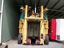
Coffee bean Harvester, Mareeba
References
- ↑ 1.0 1.1 Australian Bureau of Statistics (25 October 2007). "Mareeba (Urban Centre/Locality)". 2006 Census QuickStats. Retrieved 10 June 2011.
- ↑ Macquarie Dictionary, Fourth Edition (2005). Melbourne, The Macquarie Library Pty Ltd. ISBN 1-876429-14-3
- ↑ queenslandplaces.com.au/mareeba
- ↑ Premier Postal History. "Post Office List". Premier Postal Auctions. Retrieved 10 May 2014.
- ↑ "Rail Bridge over Christmas Creek (entry 15451)". Queensland Heritage Register. Queensland Heritage Council. Retrieved 2013-07-14.
- ↑ "Tyrconnel Mine and Battery (entry 15462)". Queensland Heritage Register. Queensland Heritage Council. Retrieved 2013-07-14.
- ↑ "Mareeba Shire Hall (former) (entry 16315)". Queensland Heritage Register. Queensland Heritage Council. Retrieved 23 October 2013.
- ↑ "Assay Office & Store, Mareeba (entry 16899)". Queensland Heritage Register. Queensland Heritage Council. Retrieved 2013-07-14.
- ↑ "MAREEBA QWRC". Climate statistics for Australian locations. Bureau of Meteorology. Retrieved 3 April 2013.
- ↑ http://www.mareebarodeo.com.au
External links
- University of Queensland: Queensland Places: Mareeba
- Mareeba State Primary School Website
- Mareeba Heritage Centre Website
| ||||||||||||||||||||||