Mare Tyrrhenum quadrangle
|
Map of Mare Tyrrhenum quadrangle from Mars Orbiter Laser Altimeter (MOLA) data. The highest elevations are red and the lowest are blue. | |
| Coordinates | 15°00′S 247°30′W / 15°S 247.5°WCoordinates: 15°00′S 247°30′W / 15°S 247.5°W |
|---|---|


The Mare Tyrrhenum quadrangle is one of a series of 30 quadrangle maps of Mars used by the United States Geological Survey (USGS) Astrogeology Research Program. The Mare Tyrrhenum quadrangle is also referred to as MC-22 (Mars Chart-22).[1] The Mare Tyrrhenum quadrangle contains parts of the regions Tyrrhena Terra, Hesperia Planum, and Terra Cimmeria.
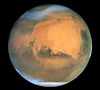
The Mare Tyrrhenum quadrangle covers the area from 225° to 270° west longitude and 0° to 30° south latitude on Mars. Schiaparelli named the area after Earth's Tyrrhenian Sea, which lies between Italy and Sicily. The region was subsequently renamed to Mare Tyrrhena after spacecraft photos revealed that it is an old, cratered plain rather than a sea. It contains the large volcano Tyrrhenus Mons, one of the oldest, and perhaps the most complex volcanoes on Mars.[2][3] Mare Tyrrhenum's largest crater is Herschel. Licus Vallis and the Ausonia Montes are other major features in the region.
Fossa on Mars
Large troughs (long narrow depressions) are called fossae in the geographical language used for Mars. Troughs form when the crust is stretched until it breaks. The stretching can be due to the large weight of a nearby volcano. Fossae/pit craters are common near volcanoes in the Tharsis and Elysium system of volcanoes.[4] A trough often has two breaks with a middle section moving down, leaving steep cliffs along the sides; such a trough is called a graben.[5] Lake George, in northern New York State, is a lake that sits in a graben. Studies have found that on Mars a fault may be as deep as 5 km, that is the break in the rock goes down to 5 km. Moreover, the crack or fault sometimes widens or dilates. This widening causes a void to form with a relatively high volume. When material slides into the void, a pit crater or a pit crater chain forms. Pit craters do not have rims or ejecta around them, like impact craters do. On Mars, individual pit craters can join to form chains or even to form troughs that are sometimes scalloped.[6] Other ideas have been suggested for the formation of fossae and pit craters. There is evidence that they are associated with dikes of magma. Magma might move along, under the surface, breaking the rock and more importantly melting ice. The resulting action would cause a crack to form at the surface. Pit craters are not common on Earth. Sinkholes, where the ground falls into a hole (sometimes in the middle of a town) resemble pit craters on Mars. However, on the Earth these holes are caused by limestone being dissolved thereby causing a void.[6][7][8] Tyrrhenus Mons has some beautiful fossae and pit craters associated with it. These features are easily visible in the gallery image below, obtained by HiRISE.
Knowledge of the locations and formation mechanisms of pit craters and fossae is important for the future colonization of Mars because they may be reservoirs of water.[9]
Craters
- Herschel Herschel (Martian crater)
- Kinkora Kinkora (crater)
- Müller Müller (Martian crater)
- Robert Shart Robert Sharp (crater)
- Resen Resen (Martian crater)
- Kinkora Kinkora Crater
- Briault Briault Crater
Why are Craters important?
The density of impact craters is used to determine the surface ages of Mars and other solar system bodies.[10] The older the surface, the more craters present. Crater shapes can reveal the presence of ground ice.
The area around craters may be rich in minerals. On Mars, heat from the impact melts ice in the ground. Water from the melting ice dissolves minerals, and then deposits them in cracks or faults that were produced with the impact. This process, called hydrothermal alteration, is a major way in which ore deposits are produced. The area around Martian craters may be rich in useful ores for the future colonization of Mars.[11]
-

Depression on crater floor, as seen by HiRISE under HiWish program. This scene is enlarged in the next two images.
-

Close-up of depression on crater floor, as seen by HiRISE under HiWish program.
-

Close-up of west edge of crater depression, as seen by HiRISE under HiWish program.
-

Dunes in crater, as seen by HiRISE under HiWish program. Some of these dunes are Barchans.
-

Dunes among craters, as seen by HiRISE under HiWish program. Some of these dunes are Barchans.
Channels
There is enormous evidence that water once flowed in river valleys and channels on Mars. Images of curved channels have been seen in images from Mars spacecraft dating back to the early seventies with the Mariner 9 orbiter.[12][13][14][15] Vallis (plural valles) is the Latin word for valley. It is used in planetary geology for the naming of landform features on other planets, including what could be old river valleys that were discovered on Mars, when probes were first sent to Mars. The Viking Orbiters caused a revolution in our ideas about water on Mars; huge river valleys were found in many areas. Space craft cameras showed that floods of water broke through dams, carved deep valleys, eroded grooves into bedrock, and traveled thousands of kilometers.[16][17][18] Some valles on Mars (Mangala Vallis, Athabasca Vallis, Granicus Vallis, and Tinjar Valles) clearly begin at graben. On the other hand, some of the large outflow channels begin in rubble-filled low areas called chaos or chaotic terrain. It has been suggested that massive amounts of water were trapped under pressure beneath a thick cryosphere (layer of frozen ground), then the water was suddenly released, perhaps when the cryosphere was broken by a fault.[19] [20]
-

Small meandering channel in the stream bed of a larger channel. Water probably eroded the two channels at different times. Image from HiRISE under the HiWish program.
-

Channel in Ausonia Mensa, as seen by HiRISE under the HiWish program.
-

Licus Vallis, as seen by HiRISE.
Gallery
-

Map of Mare Tyrrhenum quadrangle. Tyrrhenus Mons is a major volcano.
-

The Ausonia Montes in Mare Tyrrhenum as seen by CTX.
-

Tyrrhenus Mons, as seen by HiRISE and suggested by Ehsan Sanaei's high school astronomy club in Yazd, Iran. Click on image to see excellent view of pit crater chains and concentric features around a volcano.
See also
References
| Wikimedia Commons has media related to Mare Tyrrhenum quadrangle. |
- ↑ Davies, M.E.; Batson, R.M.; Wu, S.S.C. “Geodesy and Cartography” in Kieffer, H.H.; Jakosky, B.M.; Snyder, C.W.; Matthews, M.S., Eds. Mars. University of Arizona Press: Tucson, 1992.
- ↑ Hartmann, W. 2003. A Traveler's Guide to Mars. Workman Publishing. NY NY.
- ↑ Michael H. Carr (2006). The surface of Mars. Cambridge University Press. ISBN 978-0-521-87201-0. Retrieved 21 March 2011.
- ↑ Skinner, J., L. Skinner, and J. Kargel. 2007. Re-assessment of Hydrovolcanism-based Resurfacing within the Galaxias Fossae Region of Mars. Lunar and Planetary Science XXXVIII (2007)
- ↑ http://hirise.lpl.arizona.edu/PSP_008641_2105
- ↑ 6.0 6.1 Wyrick, D., D. Ferrill, D. Sims, and S. Colton. 2003. Distribution, Morphology and Structural Associations of Martian Pit Crater Chains. Lunar and Planetary Science XXXIV (2003)
- ↑ http://www.swri.edu/4org/d20/DEMPS/planetgeo/planetmars.html
- ↑ http://www.msss.com/mars_images/moc/2004/01/29/index.html
- ↑ Ferrill, D., D. Wyrick, A. Morris, D. Sims, and N. Franklin. 2004. Dilational fault slip and pit chain formation on Mars 14:10:4-12
- ↑ http://www.lpi.usra.edu/publications/slidesets/stones/
- ↑ http://www.indiana.edu/~sierra/papers/2003/Patterson.html.
- ↑ Baker, V. 1982. The Channels of Mars. Univ. of Tex. Press, Austin, TX
- ↑ Baker, V., R. Strom, R., V. Gulick, J. Kargel, G. Komatsu, V. Kale. 1991. Ancient oceans, ice sheets and the hydrological cycle on Mars. Nature 352, 589–594.
- ↑ Carr, M. 1979. Formation of Martian flood features by release of water from confined aquifers. J. Geophys. Res. 84, 2995–300.
- ↑ Komar, P. 1979. Comparisons of the hydraulics of water flows in Martian outflow channels with flows of similar scale on Earth. Icarus 37, 156–181.
- ↑ Hugh H. Kieffer (1992). Mars. University of Arizona Press. ISBN 978-0-8165-1257-7. Retrieved 7 March 2011.
- ↑ Raeburn, P. 1998. Uncovering the Secrets of the Red Planet Mars. National Geographic Society. Washington D.C.
- ↑ Moore, P. et al. 1990. The Atlas of the Solar System. Mitchell Beazley Publishers NY, NY.
- ↑ Carr, M. 1979. Formation of martian flood features by release of water from confined aquifers. J. Geophys. Res. 84: 2995-3007.
- ↑ Hanna, J. and R. Phillips. 2005. Tectonic pressurization of aquifers in the formation of Mangala and Athabasca Valles on Mars. LPSC XXXVI. Abstract 2261.
Recommended reading
- Lorenz, R. 2014. The Dune Whisperers. The Planetary Report: 34, 1, 8-14
- Lorenz, R., J. Zimbelman. 2014. Dune Worlds: How Windblown Sand Shapes Planetary Landscapes. Springer Praxis Books / Geophysical Sciences.

| Quadrangles on Mars | |||||||||||||||||||||||
|---|---|---|---|---|---|---|---|---|---|---|---|---|---|---|---|---|---|---|---|---|---|---|---|
| MC-01 Mare Boreum (features) | |||||||||||||||||||||||
| MC-05 Ismenius Lacus (features) |
MC-06 Casius (features) |
MC-07 Cebrenia (features) |
MC-02 Diacria (features) |
MC-03 Arcadia (features) |
MC-04 Acidalium (features) | ||||||||||||||||||
| MC-12 Arabia (features) |
MC-13 Syrtis Major (features) |
MC-14 Amenthes (features) |
MC-15 Elysium (features) |
MC-08 Amazonis (features) |
MC-09 Tharsis (features) |
MC-10 Lunae Palus (features) |
MC-11 Oxia Palus (features) | ||||||||||||||||
| MC-20 Sinus Sabaeus (features) |
MC-21 Iapygia (features) |
MC-22 Mare Tyrrhenum (features) |
MC-23 Aeolis (features) |
MC-16 Memnonia (features) |
MC-17 Phoenicis Lacus (features) |
MC-18 Coprates (features) |
MC-19 Margaritifer Sinus (features) | ||||||||||||||||
| MC-27 Noachis (features) |
MC-28 Hellas (features) |
MC-29 Eridania (features) |
MC-24 Phaethontis (features) |
MC-25 Thaumasia (features) |
MC-26 Argyre (features) | ||||||||||||||||||
| MC-30 Mare Australe (features) | |||||||||||||||||||||||