Maple Leaf, Seattle

Maple Leaf is a mostly residential neighborhood in Seattle, originally a rural suburb (subdivided c. 1894) named Maple Leaf Addition to the Green Lake Tract or Green Lake Circle. The name may have come from the Maple Saw Mill that operated to the east on Lake Washington or from maple trees that once grew in the area,[1] though a popular story is that in the early days of Seattle's settlement the neighborhood was "so far north, it might as well have been Canada", and was named "Maple Leaf" as an inside joke.
The original plat is located between what would later be named NE 85th and 105th Streets and 5th and 25th Avenues NE.[2] It was annexed to Seattle in the early 1950s.[3] Although Seattle neighborhood boundaries are unofficial, the current approximate neighborhood boundaries are, starting from the south and working clockwise, NE 75th Street west to Banner Way NE, north on Banner Way to Interstate 5, then north along the edge of I-5 up to NE 103rd. Then east along NE 103rd to 5th Avenue NE, north to Northgate Way, then east to Roosevelt Way NE. South along Roosevelt to Thornton Creek and then east along the creek bed to Lake City Way NE (roughly at NE 98th). Then south along Lake City Way NE to 75th Ave NE map.
Maple Leaf is bordered on the south by the Roosevelt neighborhood; to the north by Pinehurst and Victory Heights neighborhoods of the Northgate district; to the east by the Lake City and Wedgwood neighborhoods; and to the west by the North College Park or Licton Springs neighborhood, map. (Seattle neighborhoods boundaries are informal).[4]
Maple Leaf is home to approximately 20,000 residents, many residing in classic Seattle boxes, bungalows, and Tudoresque style houses. Since 2000 the Maple Leaf area has been undergoing considerable renovation as smaller, older homes sitting on 1/8 acre lots are being bulldozed to make room for new high-end "Craftsman"-style homes and, especially along Roosevelt Way NE from Snappy Dragon to Walgreens, townhomes.
Besides Northgate Mall (1950),[5] most of the businesses within Maple Leaf line Roosevelt Way NE from NE 75th to 100th Streets and 5th Avenue NE from NE 85th to 90th Streets. Notable neighborhood meeting spots on Roosevelt include Cloud City Coffee at 88th, family-owned Maple Leaf Ace Hardware at 91st, Judy Fu's Snappy Dragon at 90th, The Roosevelt Alehouse at 89th, the Reservoir Bar at 85th, and the Maple Leaf Grill at 92nd, while neighborhood meeting spots on 5th Avenue NE include Cafe Javasti and the San Marco Grocery at 84th. Cabinetworks on Roosevelt is long-established and one of the few woodworking manufacturers remaining in Seattle.
Distinctive features of the neighborhood include the water tower and reservoir located at 85th and Roosevelt, plus historic Waldo Hospital at 85th NE and NE 15th. The water tower is painted with a distinctive coupling of maple leaves viewable from Interstate 5. Across Roosevelt Way from the water tower and reservoir is Saint Catherine's School and Church. Just south is The Fairview Church and The Fairview School, one of the largest private primary schools in the city. Waldo Hospital was previously occupied by Camp Fire Boys and Girls.
Maple Leaf is one of two homes for a flock of feral conures (parrots) descended from escaped pets. They fly between Maple Leaf and Seward Park.[6]
The highest point in Maple Leaf, located on 91st Street between Roosevelt Way and 5th Avenue, is over 500 feet (150 m) in elevation, one of the highest points in the city. (High Point in West Seattle is 20 feet (6.1 m) higher.)
Schools and library
Schools
There are two public elementary schools in Maple Leaf which are part of the citywide Seattle Public Schools district. Olympic View Elementary School is a 20-room, 2-story brick building located on the 500 block of 95th Street. Founded in 1903 as the East Oak Lake School, Olympic View is one of the oldest schools in the city. The current building was constructed in 1989.[7] The other public school is Sacajawea Elementary School which opened in 1955 and is located on the 9500 block of 20th Avenue. The school was named after Sacagawea, a Shoshone Indian woman who helped to guide the Lewis and Clark Expedition.[8]
Along with the two public elementary schools Maple Leaf is home to a handful of private schools.
- The Fairview School: A K-8th grade school affiliated with the Church of God.[9] The building was built in 1908 and housed a public elementary school for 70-years. After the school closed the site was put up for bid with the neighborhood feircly opposing a plan to convert the school to low income housing units. Originally the site was sold to the Pacific Northwest Ballet but after that deal fell through the Woodland Park Avenue church purchased the building.[10]
- St. Catherine School: The only catholic school in the area, St. Catherine serves students ranging from K-8th grade. The school was founded in 1941 and was staffed by the Sisters of Providence for 35-years.[11]
- MMSC Day school: A Jewish school serving elementary students as well as high school girls.[12]
- The Perkins School: A K-5th grade school located on 9000 block of Roosevelt.[13]
Library
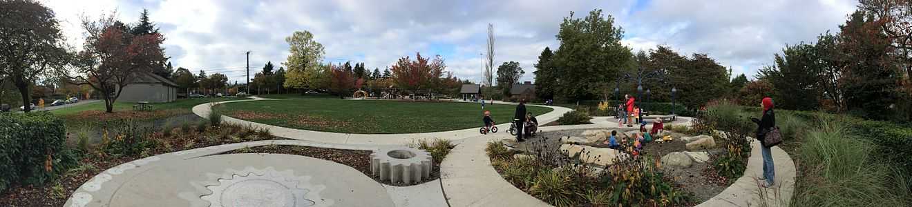
The Northgate Library, which is a branch of the Seattle Public Library system, is located on 10500 block of 5th Avenue, across from Northgate Mall. The library and the adjacent community center and park opened in July 2006.[14]
References
- ↑ (1) Wilma. (Also name as "Green Lake Tract".)
(2) "Green Lake Circle", Lange - ↑ Although the "Seattle City Clerk's Neighborhood Map Atlas" (see also the following note) still refers to 85th Street as the lower boundary of Maple Leaf, the Maple Leaf Community Council uses 75th as the lower boundary. The City of Seattle's Department of Neighborhoods also reflects this by defining the boundaries of Roosevelt neighborhood on Maple Leaf's southern border to extend north to 75th Street.
- ↑ Lange
- ↑ (1) Wilma. (1.1) With respect to historical documentation [Wilma], the Seattle City Clerk's Neighborhood Map Atlas has a discrepancy regarding the south boundary with Roosevelt and the northern boundary.
(2) "Maple Leaf". Seattle City Clerk's Neighborhood Map Atlas. Office of the Seattle City Clerk. n.d., map .jpg c. 2002-06-17. Retrieved 2006-04-21.
Maps "NN-1030S", "NN-1040S".jpg dated 17 June 2002.
(3) "About the Seattle City Clerk's On-line Information Services". Information Services. Seattle City Clerk's Office. 2006-04-30. Retrieved 2006-05-21.
See heading, "Note about limitations of these data". - ↑ Wilma
- ↑ "Parrots". BirdWeb, Seattle Audubon Society. 2005. Retrieved 2006-04-21.
- ↑ "Seattle Public Schools, 1862-2000: Olympic View School". Historylink.org. Retrieved 19 December 2013.
- ↑ "Seattle Public Schools, 1862-2000: Sacajawea Elementary School". Historylink.org. Retrieved 19 December 2013.
- ↑ "About the Fairview Church". The Fairview Church. Retrieved 29 December 2013.
- ↑ Built for Learning: Seattle Public Schools History (PDF). Seattle Public Schools http://www.seattleschools.org/modules/groups/homepagefiles/cms/1583136/File/Departmental%20Content/history%20book/fairview.pdf. Retrieved 29 December 2013. Missing or empty
|title=(help) - ↑ "Our History". St. Catherine School. Retrieved 29 December 2013.
- ↑ "MMSC Day School Home Page". MMSC Day School. Retrieved 29 December 2013.
- ↑ "History of The Perkins School". The Perkins School. Retrieved 29 December 2013.
- ↑ "About the Northgate Branch". The Seattle Public Library. Retrieved 1 January 2014.
- "About the Seattle City Clerk's On-line Information Services". Information Services. Seattle City Clerk's Office. 2006-04-30. Retrieved 2006-05-21.
See heading, "Note about limitations of these data". - Lange, Greg (2001-05-16). "Seattle beginnings: Maple Leaf Post Office opens on August 21, 1889". HistoryLink.org Essay 3279. Retrieved 2006-04-21.
Lange referenced Guy Reed Ramsey, Postmarked Washington, 1850-1960, microfilm (Olympia: Washington State Library, February, 1966), p. 622. - "Maple Leaf". Seattle City Clerk's Neighborhood Map Atlas. Office of the Seattle City Clerk. n.d., map .jpg c. 2002-06-17. Retrieved 2006-04-21.
Maps "NN-1030S", "NN-1040S".jpg dated 17 June 2002.
Note caveat in footer. - "Maple Leaf History: A Bit of History in Leaps and Bounds". City of Seattle. Retrieved 2006-04-21.
|first1=missing|last1=in Authors list (help)
No sources listed on web page, so . Maple Leaf Community Council, PO Box 75595, Seattle, WA 98175-0595. - "Northgate". Seattle City Clerk's Neighborhood Map Atlas. Office of the Seattle City Clerk. n.d., map .jpg 2002-06-17. Retrieved 2006-04-21.
Note caveat in footer. - "Parrots". BirdWeb, Seattle Audubon Society. 2005. Retrieved 2006-04-21.
- Reynolds, Malvina (1963 Schroder Music Co.). "Little Boxes". Lieder mit Midi Melodies. Retrieved 2006-04-21. Check date values in:
|date=(help)
Original lyrics.
Copyright info - Wilma, David (2001-07-20). "Seattle Neighborhoods: Maple Leaf -- Thumbnail History". HistoryLink.org Essay 3454. Retrieved 2006-04-21.
Wilma referenced Mimi Sheridan and Carol Tobin, Licton Springs History, (Seattle: Licton Springs Community Council, 2001), 8;
Don Sherwood, "Sacajawea P.F.", in "Interpretive Essays of the Histories of Seattle's Parks and Playfields", handwritten bound manuscript dated 1977, Seattle Room, Seattle Public Library. - Wilson, Kimberly A. C. "Neighborhood is another one of Seattle's best-kept secrets". Seattle Post-Intelligencer. Seattle Post-Intelligencer. Retrieved 2006-09-30.
Note esp. the 75th Street border.
Notes
Coordinates: 47°41′51″N 122°19′09″W / 47.69750°N 122.31917°W