Maolin District
Coordinates: 22°55′39″N 120°44′45″E / 22.927409°N 120.745872°E
| Maolin 茂林區 | |
|---|---|
| Mountain Indigenous District | |
| Maolin District | |
 Miaolin District in Kaohsiung City | |
| Country |
|
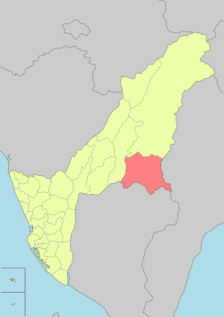
| Municipality | Kaohsiung City |
| Boroughs |
List
|
| Government | |
| • Type | District government |
| • District chief | Angopaw Komola[1] (KMT) |
Maolin District (Chinese: 茂林區; pinyin: Màolín Qū) is a rural district of Kaohsiung, Taiwan. Maolin is one of the least populated districts in Taiwan, since it is located just to the South of the Central Mountain Range. The height ranges from 230 meters to 2700 meters above sea level, with a hot tropical and humid weather. The main population of Maolin district is the Rukai population or the Taiwanese aborigines. Maolin is well suited for tourism due to its unique scenery and ecology. In 2001 December, it is officially made the Maolin National Park of Taiwan.
Geography
With a population of 1,915 as of December 2014, Maolin District has the least number of population among other districts in Kaohsiung.
- Area: 194 km2
- Population: 1,915 people (December 2014)
- Postal Code: 851
- Households: 584
History
During the period of Japanese rule, Maolin was grouped with Namasia District and Tauyuan District and classified as "Savage Land" (蕃地), which was governed under Kizan District (旗山郡) of Takao Prefecture.
Administrative divisions
Maolin District consists of 3 urban villages and 19 neighborhoods. Along with Namasia District, Maolin District has the least number of village among other districts in Kaohsiung.[2]
- Duona Village (多納里)
- Maolin Village (茂林里)
- Wan Shan Village (萬山里)
| Miaolin District administrative divisions |
|
Duona Village
Maolin
Village Wan
Shan Village |

Tourist attractions
- Duona Hot Spring
- Duona Stone Houses
- Duona Suspension Bridge
- Gorge of Serenity
- Lover's Gorge
- Maolin Gorge
- Maolin National Scenic Area
- Meiya Gorge
- Mount Dragon Head
- Mount Gueishing
- Mount Serpent Head
- Old Jiadong Tree
See also
References
External links
| ||||||||||||||||||||||||||||||||||
.svg.png)
| |||||||||||||||||||||||||||||||||||||||||||||||||||||||||||||||||||||||||||||||||||||
