Manzac-sur-Vern
| Manzac-sur-Vern | |
|---|---|
|
The village of Manzac-sur-Vern | |
 Manzac-sur-Vern | |
|
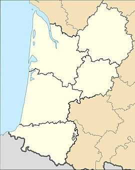
Location within Aquitaine region  Manzac-sur-Vern | |
| Coordinates: 45°05′16″N 0°35′11″E / 45.0878°N 0.5864°ECoordinates: 45°05′16″N 0°35′11″E / 45.0878°N 0.5864°E | |
| Country | France |
| Region | Aquitaine |
| Department | Dordogne |
| Arrondissement | Périgueux |
| Canton | Saint-Astier |
| Intercommunality | Astérienne Isle et Vern |
| Government | |
| • Mayor (2008–2014) | Michel Girard |
| Area1 | 19.96 km2 (7.71 sq mi) |
| Population (2008)2 | 527 |
| • Density | 26/km2 (68/sq mi) |
| INSEE/Postal code | 24251 / 24110 |
| Elevation |
81–214 m (266–702 ft) (avg. 100 m or 330 ft) |
|
1 French Land Register data, which excludes lakes, ponds, glaciers > 1 km² (0.386 sq mi or 247 acres) and river estuaries. 2 Population without double counting: residents of multiple communes (e.g., students and military personnel) only counted once. | |
Manzac-sur-Vern is a commune in the Dordogne department in Aquitaine in southwestern France.
History
There are near the town both prehistoric Gallo-Roman traces. In the Middle Ages, Manzac had a former Priory of the Abbey of Brantôme and in November 27, 1911, the commune of Manzac was renamed Manzac-sur-Vern
Notible residents
- Léonce Cubélier de Beynac (1866-1942), poet.
- Christian Pabœuf (1956- ) composer.
- Valentin Huot (1929-) cyclist.
Population
| Historical population | ||
|---|---|---|
| Year | Pop. | ±% |
| 1962 | 437 | — |
| 1968 | 401 | −8.2% |
| 1975 | 420 | +4.7% |
| 1982 | 417 | −0.7% |
| 1990 | 488 | +17.0% |
| 1999 | 505 | +3.5% |
| 2008 | 527 | +4.4% |
Gallery
Manzac-sur-Vern village
Significant Landmarks
Saint-Pierre-ès-links façard
Significant landmarks include the Saint-Pierre-ès-links a 15th-century church with façade (shown right) dating from the 19th century and Gothic bell tower.
- Chartreuse de la Faye a listed historical site.[1]
- Leyzarnie Castle, rebuilt in the early 20th century, also a listed historic monuments.[2]
- Tower of the former Castle of the Châtenet.]][3]
- Chartreuse of Couture.
- Manor de dives du, from the 17th century.[4]
- Cluzeau à Bencharel.
See also
References
- ↑ Jean-Marie Bélingard, Dominique Audrerie et Emmanuel du Chazaud (préf. André Chastel), Le Périgord des chartreuses, Périgueux, Pilote 24 édition, mai 2000, 341 p. (ISBN 2-912347-11-4), p. 100
- ↑ Château de Leyzarnie, consultée le 16 décembre 2012.
- ↑ Guy Penaud, Dictionnaire des châteaux du Périgord, p. 79, éditions Sud Ouest, 1996.
- ↑ Guy Penaud, Dictionnaire des châteaux du Périgord, p. 98, éditions Sud Ouest, 1996, ISBN 2-87901-221-X
| Wikimedia Commons has media related to Manzac-sur-Vern. |