Mansfield District
| Mansfield District | |
|---|---|
| District Council | |
|
| |
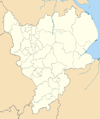
 Shown within Nottinghamshire | |
| Sovereign state | United Kingdom |
| Constituent country | England |
| Region | East Midlands |
| Ceremonial county | Nottinghamshire |
| Admin. HQ | Mansfield |
| Government | |
| • Type | Mansfield District Council |
| • Leadership: | Mayor & Cabinet |
| • Executive: | Mansfield Independent Forum and Labour 2011 |
| • Mayor | Tony Egginton (Independent) |
| • MP: | Sir Alan Meale |
| Area | |
| • Total | 29.61 sq mi (76.70 km2) |
| Area rank | 248th |
| Population (2011 est.) | |
| • Total | 104,600 |
| • Rank | Ranked 222nd |
| • Density | 3,500/sq mi (1,400/km2) |
| Time zone | Greenwich Mean Time (UTC+0) |
| • Summer (DST) | British Summer Time (UTC+1) |
| ONS code |
37UF (ONS) E07000174 (GSS) |
| Ethnicity |
97.5% White 1.0% S.Asian |
| Website | mansfield.gov.uk |
Mansfield is a local government district in Nottinghamshire, England.
History
The district was formed on 1 April 1974, under the Local Government Act 1972, being a merger of the municipal borough of Mansfield, combined with the urban districts of Mansfield Woodhouse and Warsop.
Geography
Settlements in the district include Mansfield itself, where the council is based, together with Mansfield Woodhouse, Forest Town and parts of Pleasley, with Warsop and Meden Vale distanced and annexed by open countryside. The district is entirely unparished apart from Warsop, which retains a parish council.[1]
Mansfield District Council
Unlike most English councils, Mansfield District Council is led by a directly elected mayor, following a campaign by local businessman Stewart Rickersey to achieve a referendum to change the governance away from the traditional CEO (Chief Executive Officer) and elected Chairman-with-Cabinet, composed of councillors entitled Cabinet Members.[2]
The replacement was a MD (Managing Director) as Head of Paid Service with Directors, Heads of Service and Line Managers providing the council's day-to-day services, together with a Mayor holding Executive powers and his cabinet composed of councillors entitled Portfolio Holders.
The Mayor of Mansfield is currently Tony Egginton, in-post since late 2003, an independent and part of Mansfield Independent Forum party. Following the last election in 2011, Independent Forum lost overall control having held majority seats from the 2003[3] and subsequent 2007 elections.[4]
In time for the 2011 elections, the wards and boundaries were re-organised by the Mayor resulting in 36 single-member wards.[5]
At the 2011 elections, Mayor Egginton was again successful, but only by a very small margin of 67 votes based on AV – secondary voting – and after two recounts.[6] The council initially comprised 26 Labour members and 10 Mansfield Independent Forum. No Liberal Democrats or Conservatives were elected.[7][8]
One Labour member – elected for the Park Hall ward – died shortly after the election,[7] with the subsequent by-election again returning a Labour councillor.[9]
Two Labour members – elected to the Bull Farm and Pleasley Hill and Yeoman Hill wards – then changed their allegencies, creating their own Labour 2011 party. The Mayor assembled his Cabinet from Independents and Labour 2011, and, despite Labour holding the majority with 24 (from an initial 26) members, there has been no Labour presence on the Mayor's Cabinet.
References
- ↑ Warsop Web. Official website, Parish Council Section. Retrieved 2013-12-20
- ↑ Chad, local newspaper May 2002. Businessman salutes historic victory in mayoral referendum Retrieved 2013-12-22
- ↑ Mansfield District Council, election results 2003 Retrieved 2013-12-22
- ↑ Mansfield District Council, election results 2007, retrieved 10 Jan 2011.
- ↑ Chad, local newspaper. Have your say on council ward restructure Retrieved 2013-12-22
- ↑ Mansfield 103.2 FM Local radio station Election results Retrieved 2013-12-22
- ↑ 7.0 7.1 Chad, local newspaper 11 May 2011 Mayor is elected but Labour in control "Labour councillor Dorothy Beastall died on Friday following a short illness - just five hours after she was elected to the new Park Hall ward..." Accessed 2013-12-22
- ↑ Mansfield District Council election 2011 Full results .pdf document Retrieved 2013-12-22
- ↑ Mansfield District Council Park Hall Ward by-election 2011 results .pdf document Retrieved 2013-12-22
External links
| ||||||||||||||||||||||||||||
| ||||||||||||||||||
Coordinates: 53°09′N 1°12′W / 53.15°N 1.20°W