Mannsville, Albany County, New York
| Mannsville, Albany County | |
| Mannville | |
| hamlet | |
| Official name: Mannsville, New York | |
| Name origin: for Francis N. Mann | |
| Country | United States |
|---|---|
| State | New York |
| Region | Capital District |
| County | Albany |
| Municipality | Town of Colonie |
| Coordinates | 42°43′30″N 73°42′42″W / 42.72500°N 73.71167°WCoordinates: 42°43′30″N 73°42′42″W / 42.72500°N 73.71167°W |
| Area | .029 sq mi (0 km2) |
| Population | appr. 175 (1998) |
| Density | 6,034.48 / sq mi (2,330 / km2) |
| Settled | 1875 |
| Timezone | EST (UTC-5) |
| - summer (DST) | EDT (UTC-4) |
| ZIP Code | 12189 |
| Area code | 518 |
|
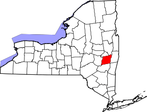
Location of Mannsville within the state of New York
| |
Mannsville is a hamlet within the town of Colonie, Albany County, New York. It is a small community west of the city of Watervliet and is inaccessible to the rest of Colonie by car without driving through Watervliet first. Though then-town historian Jean Olton stated in 1987 that Mannsville was no longer considered "an official hamlet" of the town it is still listed on the Town of Colonie's Town Historian website as a hamlet (misspelled as Mansville).[1][2]
History
In 1875 Francis N. Mann purchased most of what is now Mannsville from John Schuyler. Mann was a judge in the Town of Watervliet (not to be confused with the neighboring city of Watervliet). He died a few months later, and his children- Francis N. Mann Jr., Elias P. Mann and Emily Mann inherited the land. In 1905 they moved to England without disposing of the land or arranging for the property taxes to be paid. Albany County eventually foreclosed, auctioning the land off in lots leading to a boom in new housing in the 1970s.[1]
In 1998 the neighboring city of Watervliet attempted to annex the small hamlet, which at that time consisted of roughly 175 inhabitants. Colonie Town Supervisor Mary Brizzell stated the pros for staying with Colonie as being- lower taxes, access to the town golf course, youth services, and community development grant money. Watervliet Mayor Robert Carlson put forth in favor of annexation the facts that emergency and fire response times would improve, the city provides municipal garbage pick up, does not charge a fire district tax (Colonie does), the children of Mannsville already attend the Watervliet City School District, and most residents attend Watervliet churches.[3]
Geography
Mannsville is roughly 18.5 acres (75,000 m2) in area,[3] though like all hamlets, it has an ill-defined boundary. Mannsville is usually considered to be an area defined on the south by NY Route 155; to the north by 15th Street (Watervliet city line); to the east by Elbow Alley, which runs between Eighth and Ninth avenues, again the Watervliet city line; and to the west by railroad tracks.[1] Mannsville is flat and of low elevation, since 1995 residents have complained of frequent flooding due partly to beaver dams on the Kromma Kill diverting that watershed north to creeks that flow towards Mannsville, and due to increased residential construction uphill and upstream from the hamlet.[4][5]
Location
 |
City of Watervliet |  | ||
| Hamlet of Latham | |
City of Watervliet | ||
| ||||
| | ||||
| City of Watervliet Watervliet Arsenal |
| |||||||||||||||||||||||||||||
References
- ↑ 1.0 1.1 1.2 Michael McKeon (August 25, 1987). "Mannsville: Former Colonie Hamlet or Just a State of Mind". Albany Knickerbocker News. p. 4A. Retrieved 2010-02-13.
- ↑ "Town of Colonie Historian's Office: Frequently Asked Questions". Town of Colonie. June 19, 2008. Retrieved 2010-02-13.
- ↑ 3.0 3.1 Bechetta Jackson (February 8, 1998). "In Mannsville, the Question is Annexation". Albany Times Union. p. D3. Retrieved 2010-02-13.
- ↑ Mike Fricano (January 21, 2001). "Storm Causing Flood of Problems". Albany Times Union. p. E1. Retrieved 2010-02-13.
- ↑ Mike Fricano. "Flooding Remedies Could Exceed $1M". Albany Times Union. p. B4. Retrieved 2010-02-13.

