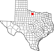
Mankins, Texas
| Mankins, Texas | |
|---|---|
| Unincorporated community | |
 Mankins Location within the state of Texas | |
| Coordinates: 33°46′56″N 98°47′50″W / 33.78222°N 98.79722°WCoordinates: 33°46′56″N 98°47′50″W / 33.78222°N 98.79722°W | |
| Country | United States |
| State | Texas |
| County | Archer |
| Elevation | 1,112 ft (339 m) |
| Population (2000) | |
| • Total | 10 |
| Time zone | Central (CST) (UTC-6) |
| • Summer (DST) | CDT (UTC-5) |
| GNIS feature ID | 1362131[1] |
MANKINS is an unincorporated community located at the intersection of U.S. Highway 82, U.S. Highway 277, and Texas State Highway 25 in Archer County, Texas, United States, 18 miles northwest of Archer City the county seat of Archer County.
Description
Area was settled around 1889. In 1890 the Wichita Valley Railway came through. Town was named after Tom Mankins who was the foreman for the nearby Lazarus Ranch. In 1909 a post office opened. By 1914 there were around 55 residents. Oil was discovered in the area in the 1920s. In 1938 a tornado came through town and destroyed the school. By 1950 there were 120 residents. The post office closed in 1963.[2]
References
| |||||||||||||||||||||||||||||
