Manjlegaon
| Manjlegaon | |
|---|---|
| city | |
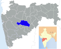
 Manjlegaon Location in Maharashtra, India | |
| Coordinates: 19°09′N 76°14′E / 19.15°N 76.23°ECoordinates: 19°09′N 76°14′E / 19.15°N 76.23°E | |
| Country |
|
| State | Maharashtra |
| District | Beed |
| Elevation | 413 m (1,355 ft) |
| Population (2001) | |
| • Total | 43,969 |
| Languages | |
| • Official | Marathi |
| Time zone | IST (UTC+5:30) |
| PIN | 431131 |
Manjlegaon is a city and a municipal council in Beed district in the Indian state of Maharashtra. Pin code of Manjlegaon is 431131. [1]
Geography
Manjlegaon is located at 19°09′N 76°14′E / 19.15°N 76.23°E.[2] It has an average elevation of 413 metres (1354 feet).
Demographics
As of 2001 India census,[3] Manjlegaon had a population of 43,969. Males constitute 51% of the population and females 49%. Manjlegaon has an average literacy rate of 64%, higher than the national average of 59.5%: male literacy is 72%, and female literacy is 56%. In Manjlegaon, 15% of the population is under 6 years of age.
References
- ↑ http://www.citypincode.in/MAHARASHTRA/BEED/MAJALGAON_PINCODE
- ↑ Falling Rain Genomics, Inc - Manjlegaon
- ↑ "Census of India 2001: Data from the 2001 Census, including cities, villages and towns (Provisional)". Census Commission of India. Archived from the original on 2004-06-16. Retrieved 2008-11-01.
| ||||||||||||||||||||||||||||