Manikchhari Upazila
| Manikchari মানিকছড়ি | |
|---|---|
| Upazila | |
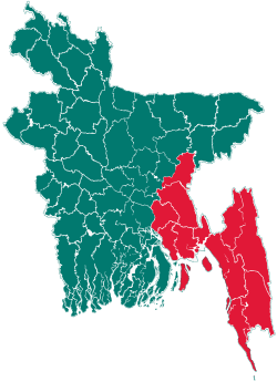
 Manikchari Location in Bangladesh | |
| Coordinates: 22°50.1′N 91°50.2′E / 22.8350°N 91.8367°ECoordinates: 22°50.1′N 91°50.2′E / 22.8350°N 91.8367°E | |
| Country |
|
| Division | Chittagong Division |
| District | Khagrachari District |
| Area | |
| • Total | 168.35 km2 (65.00 sq mi) |
| Population (1991) | |
| • Total | 38,479 |
| • Density | 229/km2 (590/sq mi) |
| Time zone | BST (UTC+6) |
| Website | Official Map of Manikchari |
Manikchari (Bengali: মানিকছড়ি) is an Upazila of Khagrachari District in the Division of Chittagong, Bangladesh.
Geography
Manikchari is located at 22°50′05″N 91°50′10″E / 22.8347°N 91.8361°E . It has 8218 units of house hold and total area 168.35 km².
Demographics
As of the 1991 Bangladesh census, Manikchari has a population of 38479. Males constitute 52% of the population, and females 48%. This Upazila's eighteen up population is 19539. Manikchari has an average literacy rate of 20.4% (7+ years), and the national average of 32.4% literate.[1]
Administrative
Manikchari has 2 Unions, 11 Wards, 5 Mouzas and 74 villages.
http://www.lgd.gov.bd/php/upprofile/upbasicdata.php?d=674
See also
References
- ↑ "Population Census Wing, BBS.". Archived from the original on 2005-03-27. Retrieved November 10, 2006.
| |||||||||||||||||||||||||||||||||||||||||||||||||||||