Manang Airport
| Manang Airport | |||||||||||
|---|---|---|---|---|---|---|---|---|---|---|---|
 | |||||||||||
 Manang Airport | |||||||||||
| Summary | |||||||||||
| Airport type | Public | ||||||||||
| Serves | Manang, Nepal | ||||||||||
| Elevation AMSL | 11,000 ft / 3,353 m | ||||||||||
| Coordinates | 28°38′28″N 84°05′17″E / 28.64112°N 84.08804°E | ||||||||||
| Runways | |||||||||||
| |||||||||||
|
Source: [1] | |||||||||||
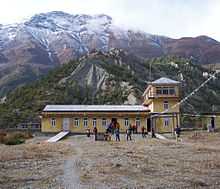
Manang Airport (IATA: NGX, ICAO: VNMA) is an airport serving Manang valley,[1] a town in the Manang district of the Gandaki zone in Nepal. The airport is situated 2,5 kilometer East of Manang town. (birds-eye distance)
Facilities
The airport resides at an elevation of 11,000 feet (3,353 m) above mean sea level.[1] It has one runway which is 610 metres (2,001 ft) in length. The Civil Aviation Authority of Nepal has been carrying out the runway expansion and improvement work at Manang Airfield. It is hoped that the further improvement of airport will be able to increase the frequency of air flight services to and from this airport. There are no roads in the area and all local traffic is on foot or carried on mule backs.
Airlines and destinations
| Airlines | Destinations |
|---|---|
| Nepal Airlines | Pokhara [2] |
| Tara Air | Kathmandu, Pokhara [3] |
References
- ↑ 1.0 1.1 1.2 Airport information for Manang, Nepal (VNMA / NGX) at Great Circle Mapper.
- ↑ "Schedule Effective from 15 May, 2010 to 30 October, 2010". Nepal Airlines. Retrieved 9 June 2010.
- ↑ http://www.taraair.com/