Mali River
Not to be confused with Mali.
| Mali River Mali Hka | |
|---|---|
 | |
| Origin | Kachin Hills |
| Mouth |
Ayeyarwady River 22°42′37″N 97°30′10″E / 22.71028°N 97.50278°ECoordinates: 22°42′37″N 97°30′10″E / 22.71028°N 97.50278°E |
| Basin countries | Myanmar |
| Length | 320 kilometres (200 mi) |
| Mouth elevation | 150 m (490 ft) |
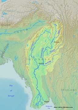
The Mali River (Mali Hka) is a river that originates in the hills of Kachin State, in the northern border of Burma. It flows approximately 320 km, when it meets with the N'Mai River and forms the Ayeyarwady River. Construction of the Myitsone Dam has begun at this confluence.[1]
See also
- List of rivers in Burma