Makrychori
| Makrychori Μακρυχώρι | |
|---|---|
 Makrychori | |
|
Location within the regional unit 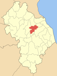 | |
| Coordinates: 39°48′N 22°29′E / 39.800°N 22.483°ECoordinates: 39°48′N 22°29′E / 39.800°N 22.483°E | |
| Country | Greece |
| Administrative region | Thessaly |
| Regional unit | Larissa |
| Municipality | Tempi |
| Districts | 4 |
| Elevation | 180 m (590 ft) |
| Population (2001)[1] | |
| • Municipal unit | 2,956 |
| Time zone | EET (UTC+2) |
| • Summer (DST) | EEST (UTC+3) |
| Postal code | 40 009 |
| Vehicle registration | ΡΙ |
Makrychori (Greek: Μακρυχώρι, Katharevousa: Μακρυχώριον) is a former municipality in the Larissa regional unit, Thessaly, Greece. Since the 2011 local government reform it is part of the municipality Tempi, of which it is a municipal unit.[2] Population 2,976 (2001). The municipality was created under the Kapodistrias Law in 1997 out of the former communes of Elateia, Evangelismos, Gyrtoni and Parapotamos.
Subdivisions
The municipal unit Makrychori is subdivided into the following communities (constituent villages in brackets):
- Elateia
- Evangelismos
- Makrychori (Makrychori, Gyrtoni)
- Parapotamos
Population
| Year | Municipality population | Municipal district population | Village population |
|---|---|---|---|
| 1991 | - | - | 1,941 |
| 1991 | 3,004 | - | 1,666 |
| 2001 | 2,976 | 1,863 | 1,787 |
Geography
Makrychori is located next to the Thessalian Plain, situated between the Pineios River and the GR-1/E75 (Athens - Larissa - Thessaloniki). The mountains can be seen to the west and east, the southern portions of the municipality are farmlands.
References
- ↑ De Facto Population of Greece Population and Housing Census of March 18th, 2001 (PDF 39 MB). National Statistical Service of Greece. 2003.
- ↑ Kallikratis law Greece Ministry of Interior (Greek)
External links
| ||||||||||||||||||||||