Maitland River (Western Australia)
| Maitland River | |
|---|---|
 | |
| Mouth | Indian Ocean |
| Basin countries | Australia |
| Length | 92 kilometres (57 mi) |
| Source elevation | 214 metres (702 ft)[1] |
| Mouth elevation | sea level |
| Basin area | 2,123 square kilometres (820 sq mi)[2] |
The Maitland River is a river in the Pilbara of Western Australia.
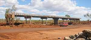
The headwaters of the river rise in the Chichester Range near Zebra Hill and it flows in a north-westerly direction. The river crosses the North West Coastal Highway south of Karratha then discharges into the Indian Ocean. The river flows through a number of permanent and semi-permanent pools on the way to the coast including Miaree Pool, Toorare Pool and Charrowie Pool.
The river has four tributaries; Four Mile Creek, Cockatoo Creek, Munni Munni Creek and Corringer Creek.
The first European to discover the river was the surveyor and explorer Francis Thomas Gregory during an expedition to the area in 1861. Gregory named the river after another member of the expedition party, volunteer Maitland Brown.[3]
The traditional owners of the area that the river flows through are the Ngaluma people.[4]
References
- ↑ "Bonzle Digital Atlas – Map of Maitland River". 2009. Retrieved 7 March 2009.
- ↑ "Modelled seabed response to possible climate change scenarios over the next 50 years in the Australian Northwest". CSIRO. 1 March 2008. Retrieved 16 January 2014.
- ↑ Western Australian Land Information Authority. "History of river names". Retrieved 7 September 2011.
- ↑ "AusAnthrop Australian Aboriginal tribal database". 2009. Retrieved 6 March 2009.
Coordinates: 20°46′37″S 116°30′38″E / 20.77694°S 116.51056°E