Maintal
| Maintal | ||
|---|---|---|
| ||
 Maintal | ||
Location of Maintal within Main-Kinzig-Kreis district 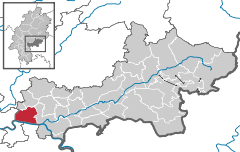
 | ||
| Coordinates: 50°09′N 08°50′E / 50.150°N 8.833°ECoordinates: 50°09′N 08°50′E / 50.150°N 8.833°E | ||
| Country | Germany | |
| State | Hesse | |
| Admin. region | Darmstadt | |
| District | Main-Kinzig-Kreis | |
| Government | ||
| • Mayor | Erhard Rohrbach | |
| Area | ||
| • Total | 32.4 km2 (12.5 sq mi) | |
| Population (2013-12-31)[1] | ||
| • Total | 36,846 | |
| • Density | 1,100/km2 (2,900/sq mi) | |
| Time zone | CET/CEST (UTC+1/+2) | |
| Postal codes | 63477 | |
| Dialling codes |
06181, 06109 (Bischofsheim) | |
| Vehicle registration | MKK | |
| Website | www.maintal.de | |

Maintal is the second largest town of the Main-Kinzig district, in Hesse, Germany. It is situated on the river Main, between Frankfurt am Main and Hanau.
Geography
Neighbouring places
Neighbouring towns and cities of Maintal are Niederdorfelden and Schöneck in the north, the city of Hanau in the East, Mühlheim am Main and Offenbach am Main on the other bank of the river Main as well as Frankfurt am Main in the west.
Division of the town
Maintal consists of the four districts Dörnigheim, Bischofsheim, Hochstadt (seat of city-administration) and Wachenbuchen.
History
The city was artificially created in 1974 in the course of the Hessian administration reform by merging the city of Dörnigheim (now Maintal's biggest district) with the nearby towns of Bischofsheim, Hochstadt and Wachenbuchen.
Economy
- Syngenta Agro GmbH
- Altec Lansing
- Rasmussen GmbH
Transportation
Maintal is connected with Hanau and Frankfurt by the so-called nordmainische Eisenbahn (northern Main railway) and has two stations (Maintal-West in Bischofsheim near the Main river and Maintal-East in Dörnigheim)
Two ferries cross the Main to the left, or south, bank. The Rumpenheim Ferry links Bischofsheim with Rumpenheim, whilst the Maintal-Dörnigheim Ferry links Dörnigheim with Mühlheim am Main.
International relations
Maintal is twinned with:
-
 Luisant (France), since April 21, 1973
 -
 Moosburg (Austria), since October 22, 1976
 -
 Amersford (Netherlands), since April 10, 1983
 -
 Esztergom (Hungary), since July 18, 1993
 -
 Katerini (Greece), since March 26, 1995
References
- ↑ "Die Bevölkerung der hessischen Gemeinden". Hessisches Statistisches Landesamt (in German). September 2014.
External links
- Official site (German)
- Maintal at DMOZ
| Wikimedia Commons has media related to Maintal. |