Mainfonds
| Mainfonds | |
|---|---|
|
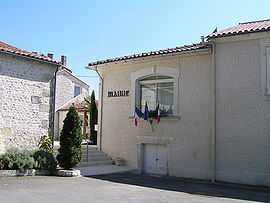
Town hall | |
 Mainfonds | |
|
Location within Poitou-Charentes region 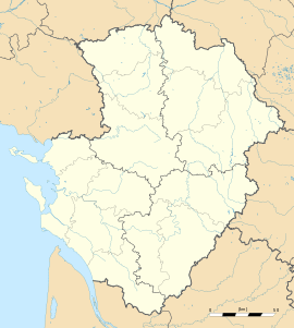 Mainfonds | |
| Coordinates: 45°31′08″N 0°01′12″E / 45.5189°N 0.02°ECoordinates: 45°31′08″N 0°01′12″E / 45.5189°N 0.02°E | |
| Country | France |
| Region | Poitou-Charentes |
| Department | Charente |
| Arrondissement | Angoulême |
| Canton | Blanzac-Porcheresse |
| Intercommunality | Blanzacais |
| Government | |
| • Mayor (2008–2014) | Jean-Pierre Barbot |
| Area1 | 9.26 km2 (3.58 sq mi) |
| Population (2008)2 | 168 |
| • Density | 18/km2 (47/sq mi) |
| INSEE/Postal code | 16201 / 16250 |
| Elevation |
65–154 m (213–505 ft) (avg. 120 m or 390 ft) |
|
1 French Land Register data, which excludes lakes, ponds, glaciers > 1 km² (0.386 sq mi or 247 acres) and river estuaries. 2 Population without double counting: residents of multiple communes (e.g., students and military personnel) only counted once. | |
Mainfonds is a commune in the Charente department in southwestern France.
Population
| Historical population | ||
|---|---|---|
| Year | Pop. | ±% |
| 1793 | 365 | — |
| 1800 | 360 | −1.4% |
| 1806 | 354 | −1.7% |
| 1821 | 362 | +2.3% |
| 1831 | 344 | −5.0% |
| 1841 | 417 | +21.2% |
| 1846 | 386 | −7.4% |
| 1851 | 386 | +0.0% |
| 1856 | 403 | +4.4% |
| 1861 | 388 | −3.7% |
| 1866 | 392 | +1.0% |
| 1872 | 386 | −1.5% |
| 1876 | 338 | −12.4% |
| 1881 | 322 | −4.7% |
| 1886 | 298 | −7.5% |
| 1891 | 293 | −1.7% |
| 1896 | 270 | −7.8% |
| 1901 | 271 | +0.4% |
| 1906 | 288 | +6.3% |
| 1911 | 335 | +16.3% |
| 1921 | 250 | −25.4% |
| 1926 | 227 | −9.2% |
| 1931 | 251 | +10.6% |
| 1936 | 244 | −2.8% |
| 1946 | 230 | −5.7% |
| 1954 | 211 | −8.3% |
| 1962 | 196 | −7.1% |
| 1968 | 199 | +1.5% |
| 1975 | 179 | −10.1% |
| 1982 | 166 | −7.3% |
| 1990 | 171 | +3.0% |
| 1999 | 142 | −17.0% |
| 2008 | 168 | +18.3% |
See also
References
| Wikimedia Commons has media related to Mainfonds. |