Maida, North Dakota
| Maida, North Dakota | |
|---|---|
| Unincorporated community | |
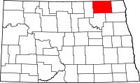
 Maida Location within the state of North Dakota | |
| Coordinates: 48°59′55″N 98°21′53″W / 48.99861°N 98.36472°WCoordinates: 48°59′55″N 98°21′53″W / 48.99861°N 98.36472°W | |
| Country | United States |
| State | North Dakota |
| County | Cavalier |
| Elevation | 1,562 ft (476 m) |
| Time zone | Central (CST) (UTC-6) |
| • Summer (DST) | CDT (UTC-5) |
| ZIP codes | 58255 |
| GNIS feature ID | 1030066 |
Maida (also Seven Lakes) is an unincorporated community in northern Cavalier County, North Dakota, United States. It lies along North Dakota Highway 1 north of the city of Langdon, the county seat of Cavalier County.[1] Its elevation is 1,562 feet (476 m). Maida serves as a port of entry between Canada and the United States.[2]
Various possibilities have been suggested for the etymology of the name "Maida":[3][4]
- A book read by Charles Howatt, the first postmaster
- Suggested by two Canadian bankers from a dog in a novel by Sir Walter Scott
- A clipping of "maiden" name for a haymeadow
Maida's post office was established in September 1884 and became a Rural Branch of Langdon in April 1967; the community still has its own ZIP code of 58255.[5][6]
References
- ↑ Rand McNally. The Road Atlas '08. Chicago: Rand McNally, 2008, p. 77.
- ↑ "Port Of Entry-Maida". U.S. Customs and Border Protection. Retrieved 2009-07-28.
- ↑ U.S. Geological Survey Geographic Names Information System: Maida, North Dakota, Geographic Names Information System, 1980-02-13. Accessed 2008-03-28.
- ↑ Wick, Douglas A. North Dakota Place Names. Hedemarken Collectibles. ISBN 0-9620968-0-6.
- ↑ Patera, Alan H. and Gallagher, John S. (1982). North Dakota Post Offices 1850-1982. Burtonsville, Maryland: The Depot. p. 46.
- ↑ Zip Code Lookup
| |||||||||||||||||||||||||