Mahakali, Mahakali Zone
| Mahakali, Nepal महाकाली | |
|---|---|
| Village development committee | |
 Mahakali, Nepal Location in Nepal | |
| Coordinates: 29°23′N 80°18′E / 29.39°N 80.30°ECoordinates: 29°23′N 80°18′E / 29.39°N 80.30°E | |
| Country |
|
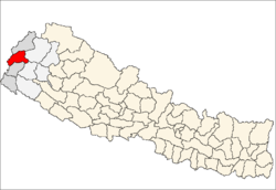
| Zone | Mahakali Zone |
| District | Baitadi District |
| Population (1991) | |
| • Total | 2,589 |
| • Religions | Hindu |
| Time zone | Nepal Time (UTC+5:45) |
Mahakali is a village development committee in Baitadi District in the Mahakali Zone of western Nepal. It is located on the Mahakali River which is also the border with Uttarakhand state, India across from Jhulaghat. Indian and Nepalese nationals cross without restrictions, however there is a customs checkpoint for goods.
Demographics
At the time of the 1991 Nepal census it had a population of 2,589 and had 412 houses in the village.[1]
References
- ↑ "Nepal Census 2001". Nepal's Village Development Committees. Digital Himalaya. Retrieved 2008-08-26.