Magpa
| Makpa माक्पा | |
|---|---|
| Village Development Committee | |
 Makpa Location in Nepal | |
| Coordinates: 27°20′N 86°46′E / 27.34°N 86.76°ECoordinates: 27°20′N 86°46′E / 27.34°N 86.76°E | |
| Country |
|
| Zone | Sagarmatha Zone |
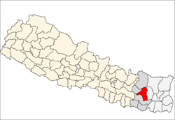
| District | Khotang District |
| Population (1991) | |
| • Total | 2,238 |
| Time zone | Nepal Time (UTC+5:45) |
Magpa is a village and Village Development Committee in Khotang District in the Sagarmatha Zone of eastern Nepal. At the time of the 1991 Nepal census it had a population of 2,238.[1]
References
- ↑ "Nepal Census 2001". Nepal's Village Development Committees. Digital Himalaya. Retrieved 30 September 2008.