Madison Township, St. Joseph County, Indiana
| Madison Township | |
|---|---|
| Township | |
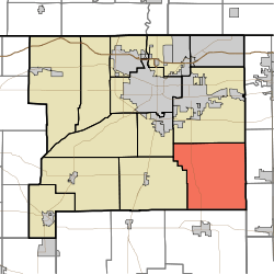 Location in St. Joseph County | |
| Coordinates: 41°31′55″N 86°07′25″W / 41.53194°N 86.12361°WCoordinates: 41°31′55″N 86°07′25″W / 41.53194°N 86.12361°W | |
| Country |
|
| State |
|
| County | St. Joseph |
| Government | |
| • Type | Indiana township |
| Area | |
| • Total | 52.12 sq mi (135 km2) |
| • Land | 52.11 sq mi (134.97 km2) |
| • Water | 0.01 sq mi (0.03 km2) 0.02% |
| Elevation | 833 ft (254 m) |
| Population (2000) | |
| • Total | 1,770 |
| • Density | 34/sq mi (13.1/km2) |
| ZIP codes | 46506, 46544, 46550, 46573, 46595, 46614 |
| GNIS feature ID | 0453598[1] |
Madison Township is one of thirteen townships in St. Joseph County, Indiana, United States. As of the 2000 census, its population was 1,770.[2]
Geography
According to the United States Census Bureau, Madison Township covers an area of 52.12 square miles (135.0 km2); of this, 52.11 square miles (135.0 km2) (99.98 percent) is land and 0.01 square miles (0.026 km2) (0.02 percent) is water.
Unincorporated towns
- Woodland at 41°33′52″N 86°10′38″W / 41.564493°N 86.177226°W
- Wyatt at 41°31′33″N 86°10′10″W / 41.525881°N 86.169448°W
(This list is based on USGS data and may include former settlements.)
Adjacent townships
- Penn Township (north)
- Olive Township, Elkhart County (east)
- Locke Township, Elkhart County (southeast)
- German Township, Marshall County (south)
- Union Township (west)
- Centre Township (northwest)
Cemeteries
The township contains Resthaven Cemetery,[3] the St. Paul Lutheran Church (LCMS) cemetery,[4] and the St. John's Church (UCC) cemetery.[5]
Major highways
School districts
- Penn-Harris-Madison School Corporation
Political districts
- Indiana's 2nd congressional district
- State House District 21
- State Senate District 9
References
- United States Census Bureau 2008 TIGER/Line Shapefiles
- United States Board on Geographic Names (GNIS)
- IndianaMap
- ↑ "Madison Township". Geographic Names Information System. United States Geological Survey. Retrieved 2009-07-07.
- ↑ United States Census Bureau American FactFinder
- ↑ http://www.findagrave.com/cgi-bin/fg.cgi?page=cr&CRid=86541&CScntry=4&CSst=17&CScnty=862&CSsr=41&
- ↑ http://www.findagrave.com/cgi-bin/fg.cgi?page=cr&CRid=2206899&CScntry=4&CSst=17&CScnty=862&CSsr=61&
- ↑ http://www.findagrave.com/cgi-bin/fg.cgi?page=cr&CRid=2181506&CScntry=4&CSst=17&CScnty=862&CSsr=41&
External links
 |
Centre Township | Penn Township | | |
| Union Township | |
Olive Township, Elkhart County | ||
| ||||
| | ||||
| German Township, Marshall County | Locke Township, Elkhart County |
| |||||||||||||||||||||||||||||||||