Maddington, Western Australia
| Maddington Perth, Western Australia | |||||||||||||
|---|---|---|---|---|---|---|---|---|---|---|---|---|---|
|
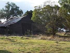
One of the buildings that form part of the original farm in Maddington | |||||||||||||
 Maddington | |||||||||||||
| Coordinates | 32°02′56″S 115°59′24″E / 32.049°S 115.990°ECoordinates: 32°02′56″S 115°59′24″E / 32.049°S 115.990°E | ||||||||||||
| Population | 9,136 (2006)[1] | ||||||||||||
| • Density | 854/km2 (2,211/sq mi) | ||||||||||||
| Postcode(s) | 6109 | ||||||||||||
| Area | 10.7 km2 (4.1 sq mi) | ||||||||||||
| Location | 20 km (12 mi) SE of Perth | ||||||||||||
| LGA(s) | City of Gosnells | ||||||||||||
| State electorate(s) | Forrestfield, Gosnells | ||||||||||||
| Federal Division(s) | Hasluck | ||||||||||||
| |||||||||||||
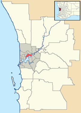
Maddington is a suburb 20 kilometres (12 mi) southeast of the central business district of Perth, the capital of Western Australia, within the City of Gosnells local government area. Maddington is a mixed-use suburb containing major residential, retail and industrial sections as well as some semi-rural areas.[2]
Unusual amongst the surrounding suburbs Maddington still retains several vineyards and orchards from when the locality was used for agricultural purposes. Maddington has a railway station and like numerous other centres, has been engaging in transit-oriented development planning.[3]
History
During the 19th century, Maddington was owned by John Randall Phillips, one of the wealthier colonists to arrive in Perth during the 1830s. Maddington Park, which Phillips named after a town in Wiltshire, England, was subdivided 70 years later as Perth dealt with the population explosion following the Gold Rush. Maddington Park became 'Maddington' – an area of varied agricultural uses including market gardens, poultry and orchards. In the 1950s and 1960s, Maddington and surrounding suburbs were further subdivided and developed into residential suburbs.[4]
During the 1960s the Canning Park race course, located in Maddington, was abandoned. William Davison, an English property developer bought up the land and developed the area into an industrial estate, which is the light industrial area which can be seen along Albany Highway and the train line today. The suburb also was the site of one of 24 new Australian Technical Colleges proposed by the Howard Government in 2005.
Maddington Central
Formerly known as Centro Maddington and Maddington Metro, the centre was built in two stages from the early 1980s to 1992. Main tenants include Coles , Woolworths, Kmart and Best & Less . Other stores include Dick Smith , Bankwest , ANZ , Red Dot Stores, NAB , Telstra Shop and the Maddington Post Office.
Maddington Central is located 20 kilometres from the Perth CBD between Olga Road, Burslem Drive and Attfield Street in Maddington. It is also accessible by Public Transport.
Gallery
-

Maddington shopping centre.
References
- ↑ Australian Bureau of Statistics (25 October 2007). "Maddington (State Suburb)". 2006 Census QuickStats. Retrieved 2007-11-27.
- ↑ "Maddington Town Centre Enquiry-by-Design Workshop Outcomes report" (PDF). City of Gosnells. July 2004. Retrieved 2007-11-27. Regional Analysis (page 5)
- ↑ "Maddington Town Centre Enquiry-by-Design Workshop Outcomes report" (PDF). City of Gosnells. July 2004. Retrieved 2007-11-27.
- ↑ "History of Suburb Names: Maddington". City of Gosnells. Retrieved 2009-04-30.
