Madaya
| Madaya | |
|---|---|
| Town | |
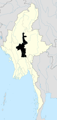
 Madaya Location in Burma | |
| Coordinates: 22°13′N 96°7′E / 22.217°N 96.117°ECoordinates: 22°13′N 96°7′E / 22.217°N 96.117°E | |
| Country |
|
| Admin. division | Mandalay |
| District | Pyin Oo Lwin District |
| Township | Madaya Township |
| Time zone | MST (UTC+6.30) |
- For Madaya in Syria, see: Madaya, Syria
Madaya is a town in the Mandalay Region of central Myanmar. It is the seat of Madaya Township. It lies along National Highway 31.[1][2]Lamaing lies just to the southeast. The Madaya River in the area is connected to the Mandalay Canal, and crosses the township of Madaya diagonally for some 30 miles and joins the Irrawaddy River.[3]
History
In the 16th century, the Gwe Shans built a stockade in the village of Okpo.[4] On October 1, 1886 there was a reported small native garrison at Madaya and nearby Lamaing and the town was subject to invasion the same month.[5][6]
References
- ↑ Google Maps (Map). Google.
- ↑ Bing Maps (Map). Microsoft and Harris Corporation Earthstar Geographics LLC.
- ↑ Imperial gazetteer of India: provincial series. Superintendent of Government Printing. 1908. p. 79. Retrieved 3 January 2011.
- ↑ E., Harvey G.; Harvey, G.E. (1 July 2000). History of Burma. Asian Educational Services. p. 211. ISBN 978-81-206-1365-2. Retrieved 3 January 2011.
- ↑ James George Scott; Hardiman, J. P. (1901). Gazetteer of Upper Burma and the Shan states. AMS Press. Retrieved 3 January 2011.
- ↑ India. Army. Intelligence Branch; Paget, William Henry (1907). Frontier and Overseas Expeditions from India: Burma. Govt. Monotype Press. Retrieved 3 January 2011.
External links
| ||||||||||
| |||||||||||||||||||||||||||||||||||||||||