Macleay Island
| Macleay Island Queensland | |
|---|---|
|
Macleay Island is one of several inhabited islands in Moreton Bay. | |
| Coordinates | 27°36′43″S 153°21′18″E / 27.612°S 153.355°ECoordinates: 27°36′43″S 153°21′18″E / 27.612°S 153.355°E |
| Population | 2,572 (2011) |
| Council seat | Redland City |
| Region | South East Queensland |
| State electorate(s) | Redlands |
| Federal Division(s) | Bowman |
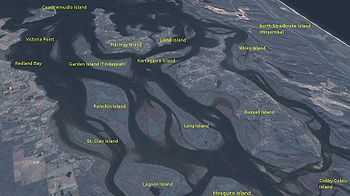
Macleay Island is an island located in Moreton Bay, South East Queensland. It is in the Redland City Council Local Government Area and has the postcode 4184. Perulpa Island is a small island attached to Macleay Island by a causeway.[1] Macleay Island is the fourth largest island in Moreton Bay after North Stradbroke Island, Moreton Island and Russell Island.
History
For some time in the 1800s the island was called Tim Shea's Island after a convict who lived on the island for more than a decade.[2] The current name was given by Surveyor Warner who named the island after Alexander Macleay who was the Colonial Secretary of New South Wales from 1825 to 1837.[2] The island has a rich history of the Aboriginal/indigenous peoples presence with middens and stone fish traps still found on the island.
Heritage listings
Macleay Island has a number of heritage-listed sites, including:
- Cliff Terrace: Industrial Ruins[3]
Environment
The island boasts much natural beauty, including untouched littoral rainforest, rocky shores, sandy beaches, mangrove areas and wonderful vistas to the mainland, over to North Stradbroke Island and up to Moreton Island. There's a large variety of birds including the migratory birds which visit yearly. There is a large Bush Stone Curlew population on the island.
Transport
The island as a part of the southern Bay Islands can be accessed by passenger or vehicular ferry from Redland Bay.[1] With the growing population, many residents commute to the mainland for work daily. Translink GoCards are used on the fast ferry service to Redland Bay, with regular bus links from the ferry terminal. The Ferry Terminal and foreshore will be upgraded in 2015 by Redland City Council, providing a new recreational boat ramp, parking, and beautification.
Facilities
Macleay has a range of shops including cafes, pizza, hot bread, restaurants and supermarkets. There's also a Dentist, Doctors, Chemist, and Vet as well as the islands emergency services. The large Community Centre and Hall is used by many local groups. A lively Progress Association runs the island's well-stocked library.
During the 2006 state election, the Queensland Government prioritised construction of a single-officer police station for on the island it was needed with the increasing population.[4] The station started operation in June, 2008.
Recreation
Macleay Island has sandy beaches and mangrove foreshores. These are popular spots for fishing, swimming, sailing, picnicking and barbecues. A popular launch spot is the new Dalpura Ramp towards the north of the island. Pat's Park at the northern end of the island is a great place for swimming, BBQs, picnics and has excellent children's play equipment. The Anzac day services are held at the Cenotaph located there. The island has a Skate Park for the younger generation which opened in 2014, also there's a number of other small parks with play equipment for children to enjoy.
Other recreational facilities include boat, bowling and golfing clubs. The Heritage Trail is well marked by signage for locals and visitors to enjoy.
Macleay is also home to a growing community of artists, some quite well known, and the Arts Centre is well used by painters, potters, sculptors, plus other crafts.
Bird watching is a popular activity.
Housing
In 2007, after a short segment on the Nine television network's nationally broadcast A Current Affair based on the comments made by real estate watcher John Edwards of Residex said that Macleay Island was a "boom suburb" and worth watching by first home buyers. All the SMBI Islands received a considerable amount of interest from buyers.[5]
A surge in building followed which forced the Redland City Council to do a review of the official census figures. It estimated 2,319 permanent residents on Macleay in 2008. However with a count of 1,479 dwellings, the peak number of people on the islands during holidays and weekends the total population is thought to have been 3,254.[6]
Demographics
The permanent population was 1,958 in the 2006 Census. However, the population includes a high number of owners who visit the island at weekends. Nearly a third of the 1,259 dwellings were listed as unoccupied at the time of the Tuesday night census.[7]
In the 2011 Census the population of Macleay Island is 2,572, 49.9% female and 50.1% male.
The median/average age of the Macleay Island population is 52 years of age, 15 years above the Australian average.
68.3% of people living in Macleay Island were born in Australia. The other top responses for country of birth were England 7.1%, New Zealand 6.7%, Germany 1.4%, Scotland 1.2%, Netherlands 0.6%.
87.9% of people speak English as their first language 1.2% German, 0.3% Italian, 0.2% French, 0.2% Auslan, 0.2% Greek.
See also
References
- ↑ 1.0 1.1 "Macleay Island". queenslandholidays.com.au (Tourism Queensland). Retrieved 9 May 2011.
- ↑ 2.0 2.1 Horton, Helen (1983). Islands of Moreton Bay. Spring Hill, Queensland: Boolarong Publications. p. 86. ISBN 0-908175-67-1.
- ↑ "Industrial Ruins, south end of Macleay Island (entry 15836)". Queensland Heritage Register. Queensland Heritage Council. Retrieved 2013-07-12.
- ↑ Hoons run amok on bay island. The Courier Mail. 5 August 2007. Retrieved 28 December 2007.
- ↑ (13 November 2007). Boom suburbs
- ↑ SMBI Population and Dwelling Profile
- ↑ Australian Bureau of Statistics (25 October 2007). "Macleay Island (Redland Shire) (State Suburb)". 2006 Census QuickStats. Retrieved 2008-02-28.
External links
| ||||||||||