Machilipatnam
| Machilipatnam మచిలీపట్టణం Masulipatnam | |
|---|---|
| City | |
|
Koneru center, the business center of Machilipatnam | |
| Nickname(s): Bandar | |
 Machilipatnam Location in Andhra Pradesh, India | |
| Coordinates: 16°10′N 81°08′E / 16.17°N 81.13°ECoordinates: 16°10′N 81°08′E / 16.17°N 81.13°E | |
| Country |
|
| State | Andhra Pradesh |
| Region | Coastal Andhra |
| District | Krishna |
| Government | |
| • MLA | Kollu Ravindra |
| Area | |
| • Total | 26.67 km2 (10.30 sq mi) |
| Elevation | 14 m (46 ft) |
| Population (2011)[1] | |
| • Total | 170,008 |
| • Density | 6,875/km2 (17,810/sq mi) |
| Languages | |
| • Official | Telugu |
| Time zone | IST (UTC+5:30) |
| PIN | 521 xxx |
| Telephone code | 91-8672 |
| Vehicle registration | AP-16 |

Machilipatnam (![]() pronunciation ) is a city in Krishna district of the Indian state of Andhra Pradesh.[2] It serves as the administrative headquarters for Machilipatnam mandal and Machilipatnam revenue division.[3][4] It was the first trading settlement on the Bay of Bengal coast established by the British East India Company. At that time, in 1611, it was also known as Masulipatnam or Masula, and as Bandar in folklore.[5]
pronunciation ) is a city in Krishna district of the Indian state of Andhra Pradesh.[2] It serves as the administrative headquarters for Machilipatnam mandal and Machilipatnam revenue division.[3][4] It was the first trading settlement on the Bay of Bengal coast established by the British East India Company. At that time, in 1611, it was also known as Masulipatnam or Masula, and as Bandar in folklore.[5]
History


The town has existed since the 3rd century BCE (Satavahana period) when, according to Ptolemy, it was known as Maisolos. The Periplus of the Erythraean Sea calls it Masalia in the 1st century BCE.[6] The port is located on the southeastern, or Coromandel Coast, of India. Situated in the mouth of the River Krishna on the Bay of Bengal, the Masula port saw flourishing sea trade. Muslin clothes were traded by ancient Greeks from the town and the word muslin originated from the name Maisolos.[7] Muslin was an important source of income for the town, being a favourite of Roman traders for domestic consumption. Several Roman coins were found during excavations of Buddhist towns located near Masulipatnam.[8]
When Marco Polo visited India, probably some time around 1289-1293, Machilipatnam was a major port of the Kakatiya dynasty. He referred to the place as Mutfili, and it was also known as Masulipatam.[9][10]
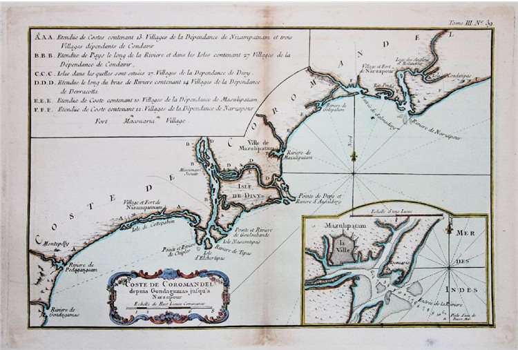
The naming of the eastern gate of Charminar as Machili-Kaman (literally meaning "gate of fish", in this case specifically meaning a gate to the fishing town of Machilipatnam) testifies the symbiotic relationship between port and the capital. There were Arab merchants in the area at least since the 13th century. The Portuguese controlled what they called Masulipatão between 1598 and 1610, when they vacated the place. The East India Company built its first factory in India in Masulipatnam. It was a 17th-century port for French, British and Dutch trade. The port has a medium-size fishing harbour which can accommodate 350 fishing vessels and an active carpet-weaving industry. The other products from the town include rice, oilseeds and scientific instruments. This town is a railway terminus and an important educational centre. Andhra Bank was established in 1923 at Machilipatnam.
The area is vulnerable to storm surges caused by the frequent cyclones in the Bay of Bengal. The 2004 Tsunami affected many fishing villages around Machilipatnam. The Government and NGOs are involved in rebuilding and reconstructing devastated villages.
Geography
Machilipatnam city is located at 16°10′N 81°08′E / 16.17°N 81.13°E[11] on the southeast coast of India and in the east corner of Andhra Pradesh. The city has an average elevation of 14 meters (45 feet). River in Machilipatnam
Climate
Machilipatnam city gets most of its annual rainfall due to the southwest monsoon. It has a tropical savanna climate (Köppen climate classification Aw) with hot summers and moderate winters. The hottest months are between April and June. The average normal rainfall in the district is 959 millimetres (37.8 in).
Machilipatnam city is frequently hit by cyclones originating in the Bay of Bengal. The Andhra Pradesh coast between Ongole and Machilipatnam is vulnerable to high surges of the sea due to cyclones. The 1977 Andhra Pradesh cyclone crossed the coast near Nizampatnam and took approximately 10,000 lives. As the storm approached the coast, gale winds reaching 200 km/h lashed Prakasam, Guntur, Krishna, East Godavari and West Godavari districts. A storm surge, 5 metres high, inundated the Krishna estuary and the coast south of Machilipatnam city (Bandar)
On 8 December 2004, a high capacity S-Band Doppler cyclone warning radar was installed, commissioned and made operational at the city.[12] It was purchased from a German manufacturer, Gematronik. With the installation of the radar, the state will be better equipped to track cyclones by the onset of monsoon, according to an official from the State Met Office talking to the newspaper The Hindu. This facility will monitor the 960 km long coastline of the state.[13] The radar's information is posted in real-time on the Indian Meteorological Department website.[14] Similar radars were installed in other coastal cities forming an S-Band Cyclone Detection Radar Network.[15]
| Climate data for Machilipatnam | |||||||||||||
|---|---|---|---|---|---|---|---|---|---|---|---|---|---|
| Month | Jan | Feb | Mar | Apr | May | Jun | Jul | Aug | Sep | Oct | Nov | Dec | Year |
| Record high °C (°F) | 32.4 (90.3) |
34.6 (94.3) |
38.1 (100.6) |
41.8 (107.2) |
46.5 (115.7) |
45.4 (113.7) |
40.8 (105.4) |
38.6 (101.5) |
36.8 (98.2) |
37.2 (99) |
33.3 (91.9) |
33.0 (91.4) |
46.5 (115.7) |
| Average high °C (°F) | 28.5 (83.3) |
30.2 (86.4) |
32.5 (90.5) |
34.6 (94.3) |
37.3 (99.1) |
36.7 (98.1) |
33.7 (92.7) |
32.6 (90.7) |
32.5 (90.5) |
31.6 (88.9) |
30.1 (86.2) |
28.8 (83.8) |
32.43 (90.38) |
| Daily mean °C (°F) | 23.8 (74.8) |
25.5 (77.9) |
27.5 (81.5) |
30.2 (86.4) |
32.4 (90.3) |
32.4 (90.3) |
29.7 (85.5) |
29.0 (84.2) |
28.9 (84) |
27.8 (82) |
25.8 (78.4) |
24.3 (75.7) |
28.11 (82.58) |
| Average low °C (°F) | 19.0 (66.2) |
20.8 (69.4) |
22.6 (72.7) |
25.7 (78.3) |
27.5 (81.5) |
27.0 (80.6) |
25.6 (78.1) |
25.4 (77.7) |
25.3 (77.5) |
24.0 (75.2) |
21.6 (70.9) |
19.9 (67.8) |
23.7 (74.66) |
| Record low °C (°F) | 14.0 (57.2) |
15.6 (60.1) |
17.3 (63.1) |
17.8 (64) |
17.6 (63.7) |
21.0 (69.8) |
18.8 (65.8) |
18.8 (65.8) |
18.1 (64.6) |
17.8 (64) |
15.3 (59.5) |
14.6 (58.3) |
14 (57.2) |
| Average precipitation mm (inches) | 6 (0.24) |
9 (0.35) |
7 (0.28) |
9 (0.35) |
20 (0.79) |
86 (3.39) |
171 (6.73) |
181 (7.13) |
156 (6.14) |
177 (6.97) |
116 (4.57) |
21 (0.83) |
959 (37.77) |
| Avg. rainy days | 0.5 | 0.6 | 0.5 | 0.8 | 2.2 | 7.7 | 13.8 | 12.6 | 10.4 | 9.2 | 5.6 | 1.2 | 65.1 |
| Average relative humidity (%) | 76 | 75 | 73 | 73 | 66 | 62 | 72 | 74 | 78 | 79 | 75 | 75 | 73.2 |
| Source: NOAA (1971–1990)[16] | |||||||||||||
Politics and administration
Machilipatnam is represented by Machilipatnam (Assembly constituency) for Andhra Pradesh Legislative Assembly. The city is a part of Machilipatnam (Lok Sabha constituency), representing the Lok Sabha.[17][18][19] Kollu Ravindra is the present MLA of the constituency from Telugu Desam Party.[20]
Economy
Machilipatnam has big industries. Fashion gold (also called rold gold or gold covering) ornaments produced there. Agriculture is the most important occupation, with rice being the main food crop. Bharat Electronics Limited (BEL), a unit of the Union Defence Ministry, of the Government of India, operates a manufacturing unit in Machilipatnam.[21] BEL is involved in design, development and manufacture of Opto-electronic equipments that are used by the Indian Defence Services and paramilitary organisations. It also produces cyclone detection radar under the IMD Department of Science and Technology.
Demographics
As of the 2001 India census,[22] Machilipatnam Municipality had a population of 183,370. The population has since decreased to 170,119 in 2011 as nearly 30,000 people migrated to surrounding villages such as Potepalli and Navinmittal colony. Males constitute 50% of the population and females 50%. Machilipatnam has an average literacy rate of 83.32%, higher than the national average of 70.04%: male literacy is 86.73%, and female literacy is 80.05%. In Machilipatnam, 8% of the population is under 6 years of age.
Culture
Muslims tend to speak Urdu. Women of all cultures and faiths typically wear the traditional Indian dress, the sari – sometimes Salwar Kameez. People in Machilipatnam practice Hinduism, Islam and Christianity. Hindus and Christians speak Telugu.
The city is well known for sweet dishes called Bandar Laddu, Musr Laddu and Bandar Halwa.[23][24][25]
Islamic Places
Mosque
- Astana E Chehlum (Mosque) located at Ghadeer Nagar, Ingudurpet, Machilipatnam
Literary organisations
Sri Ramakrishna Natya Mandali, founded by Dr. Jandhyala Radha Krishna, conducts mythological dramas. Bharathiya Sahitya Parishad, Indian Cultural Association, Hasya Lasya, Kalasagar, Padmasree Gantasala Samscruthika Sangam and Yuva Vedica are some of the leading literary missions active. The literary organisation Saahithee Mitrulu was established in Machilipatnam in 1981 by Dr. Ravi Ranga Rao. It has conducted literary and cultural programmes since then without pause, functioning chiefly to bring out the creative skills of youth and new writers; it has published at least 66 books of literature and treating of language and culture. In 1999, the organisation conducted the "Sathaavadhaanam" of Rallabandi Kavitha Prasad, created a history.
Kuchipudi
Kuchipudi, a popular Indian Classical Dance form originated at Kuchipudi, 25 kilometres from Machilipatnam. The dance form is in practice in Machilipatnam.
Arts and crafts
The Kalamkari fabrics of Machilipatnam and Kalahasti, with their intricate designs, are used in clothing and wall hangings. Kalamkari refers to dye-painted cloths and the technique used to create them. Their name derives from kalam, for a pen-like tool used to draw outlines on the cloth, and kari (work). Fabrics are outlined with a cotton-tipped bamboo stick and dyed in vegetable or mineral colours. The process involves washing, rinsing, soaking and bleaching muslin, and applying mordants and dyes using natural substances like indigo for blue, madder for red, mango bark and dried myrobalan fruit for yellow, palm sugar and rusted iron for black. The dyeing process is very elaborate and can take several days to complete. While some pieces are hand-drawn, large canvas and sheets are block-printed. The work done in Machilipatnam, often using block printing in conjunction with hand painting, features decorative floral and vegetable designs that appealed to local kingdoms and to export trade. This culminated in European demand for Machilipatnam chintz, which derives its name from the Hindi word chint (spotted cloth). Machilipatnam is also famous for imitation jewellery called Chilakalapudi Bangram – an industry involving over 200 companies and 30000 artisans. The jewellery is exported to countries in South East and Middle East Asia and is also sold domestically to the South Indian film industry. Weaving of sarees and cloth is another primary occupation.
Cuisine
Seafood is the most famous and delicious food; it is part of the servings in many restaurants served in Andhra, along with other cuisines. Sweets, mainly Bandar Laddu and Bandar Halwa, are also very famous here.
Tourism
Machilipatnam is a city with a rich history of foreign conquests, business and trade. The relics of Bandar Kota (Machilipatnam Fort) can be visited. The old light house is still standing.
Temples


Sri Sri Sri Virat Vishwakarma Devalayam Constructed By Brahmasri Kandamuri Ravikumar & Brahmasri Sriram Syam Prasad at Vishwabrahmana Colony, Machilipatnam it is to biggest and First temple of Krishna District, Andhra Pradesh. [26]
Sri Venkateswara Swamy Temple, Batchupet, Sri Nageswara Swamy Temple, Kojjillipet, Sri Ramalingeswara and Sri Ranganayakaswamy Temples, R.Pet and Sri Bhadradri Sri Ramulavari Temple, Main Road, are the most famous temples in Machlipatnam.
Sai Devalayam at the district court centre of Machilipatnam is the main attraction of the town. It has the biggest statue of Sri Saibaba of Shirdi. The Indian Book of Records has recognised it as the "Tallest Saibaba statue" by Shri. BLV Rao and Shri. Srinivas Kishan on 25 August 2011.
Dattashram is a pilgrimage site on the coast. Dattashram has an ancient Shiva temple and a recently built Datta temple. Manginapudi is popularly known as "Datta Rameswaram" due to the consecration of 12 wells for bathing (recalling those at Rameswaram).[27]
Panduranga Swamy temple at Chilakalapudi near the city, is a famous pilgrimage site. It is a temple of Lord Vishnu, said to be similar to the temple at Pandaripur.
Sivaganga Temple is a historical temple maintained by Challapalli jameendars rather than the Government. It is one of the oldest temples in the area. Located on the Avanigadda road, it attracts tourists and devotees all through the year. On Shivaratri major celebrations are carried out by the temple trustees.
Anjaneya Swami Temple, in Paraspet, was built by Samarth Ramdas, the guru of Chatrapathi Sivaji. Ghantasala, 21 km from Machilipatnam. It includes the remains of an old Buddhist stupa.
Agastheeswara Temple, 36 km from Machilipatnam, is a temple of Lord Shiva and pilgrimage site. At this temple Lord Shiva is called by the name Ekaratri Mallikarjunaswamy. An annual festival is celebrated here and the deities are taken out in procession. At Gudivada, North west of Machilipatnam, visitors are attracted by the old ruins of the stupas.
Further up the coast of Machilipatnam there are five temples dedicated to Lord Shiva. These ancient temples are located at Amravati, Samalkot, Bhimavaram, Draksharama and Chebrolu. Prasanna Anjaneya Swamy temple, located at Godugupet, has a history of over hundred years.
The Jodugudlu temple in Edepalli is also one of the oldest temples with more than 150 years of history. The temple was built during the 19th century, by Velama Doralu which is a social group found mainly in Andhra Pradesh. Velamas are classed as "warrior caste". The temple was handed over to the Endowments Department in the year 1936. Currently the temple has been developed by an un-organised group.

Beaches
The beaches in Machilipatnam city are long, broad, pristine, and with pale blonde sands. Apart from Manginapudi beach, Palletummalapalem is a beach side fishing hamlet 11 kilometres (6.8 mi) from Machilipatnam; it is well known for its scenic beauty and also as a historic port city. During its heyday this port served as a gateway to India. The beach has a natural bay with shallow waters. Recently access to the beach was banned due to some natural holes appearing underwater. The most famous beach being manginipudi beach.
The Sri Ganganamma Temple was constructed in the year of 1977 when the great cyclone came i.e. uppena at Rajupet, Machilipatnam. The Sree Ramalam temple is 2 kilometres from Palletummalapalem.
Transport
Road
The National highway NH-9 (new no NH-65) from Pune via Hyderabad and Vijayawada is being extended to Bandar Fort through Machilipatnam. A coastal National highway NH-214A (new no NH-216) from Kattipudi to Ongole via Machilipatnam was sanctioned 4 years ago.
Rail
Machilipatnam railway station,South Indian Railway station built by British to link with Shipping Yard and Public Transportation.. on a branch line linked to the Visakhapatnam-Vijayawada section of Howrah-Chennai main line, is well connected to important cities of India. The nearest city is Vijayawada, the south central railway's important railway station and junction. There are eleven passenger trains to Vijayawada, one fast passenger to Visakhapatnam and express trains to Secunderabad, Tirupathi and Bangalore.
Sea
Navayuga won GO to build a sea port in Machilipatnam. Currently the government is in the process of acquiring land for the port development.
Air
The nearest airport is Gannavaram Airport near Vijayawada, about 76 km away.
Education
Machilipatnam is an ancient and famous educational center. The Noble College Machilipatnam is one of the first four colleges in India and the first college in Andhra Pradesh. There are two other colleges with histories related to India's fight for independence, namely The Hindu College and The National College (Andhra Jateeya Kalasala). Kendriya Vidyalaya is the only school maintained by Government of India in Machilipatnam which was established in 1994. This has best teaching staff from all over India making it the only Metropolitan school in Machilipatnam with English & Hindi medium of teaching. Because of its limited number of seats, one have to undergo an Entrance test to get admission.
In the olden days many people used to come to Machilipatnam to get better education. Machilipatnam is an educational center, offering all academic courses except Medicine. It has public (state-run) and privately run schools. The local Hindu college and allied institutions offer courses ranging from kindergarten (KG) to postgraduate (PG). There are several Telugu language and English language schools. Daita Madhusudana Sastry, the former secretary and correspondent of the Hindu college and allied institutions, was instrumental in the establishment and expansion of most of the educational institutions in Machilipatnam.
Krishna University has been established in Machilipatnam as the Headquarters of Krishna District in 2008 for Higher education and University offers 9 postgraduate courses including M.A. (Tel,Eng,Journalism), MSc (Bio-Tech, Pharma Chemistry), MSc (Electronics and Instrumentation), M.Pharmacy, M.B.A and M.C.A.
Sports
Cricket & Badminton are popular sports in Machilipatnam. District level & regional matches are played at various college grounds in Machilipatnam.
See also
- List of cities in Andhra Pradesh
References
- ↑ "Cities having population 1 lakh and above" (PDF). The Registrar General & Census Commissioner,India. Retrieved 26 July 2014.
- ↑ "Krishna district profile". aponline.gov.in. Retrieved 4 August 2014.
- ↑ "Administrative Setup". Krishna District Official Website. Retrieved 20 November 2014.
- ↑ "Krishna District Mandals" (PDF). Census of India. p. 517. Retrieved 18 January 2015.
- ↑ "About Machilipatnam". Encyclopædia Britannica. Retrieved 4 August 2014.
- ↑ The Great Stupa at Nagarjunakonda in Southern India
- ↑ Periplus, Point 62; http://www.fordham.edu/halsall/ancient/periplus.html
- ↑ Buddhist Monks and Monasteries of India: Their History and Their Contribution to Indian Culture by Sukumar Butt, Motilal Banarsidas Publishers, 1988, p. 132
- ↑ Rubiés, Joan-Pau (2000). Travel and Ethnology in the Renaissance: South India through European Eyes, 1250-1625. Cambridge University Press. pp. 50, 73 – via Questia. (subscription required (help)).
- ↑ Chakravarti, Ranabir (1991). "Horse Trade and Piracy at Tana (Thana, Maharashtra, India): Gleanings from Marco Polo". Journal of the Economic and Social History of the Orient 34 (3): 159–182. JSTOR 3632243. (subscription required (help)).
- ↑ Falling Rain Genomics, Inc – Machilipatnam
- ↑ Department of Science and Technology
- ↑ The Hindu – Modern cyclone warning system for Machilipatnam
- ↑ Indian Meteorological Department website
- ↑ India Meteorological Department
- ↑ "Musulipatnam Climate Normals 1971–1990". National Oceanic and Atmospheric Administration. Retrieved 24 December 2012.
- ↑ "DELIMITATION OF PARLIAMENTARY AND ASSEMBLY CONSTITUENCIES ORDER, 2008" (PDF). Election Commission of India. p. 22,31. Retrieved 11 October 2014.
- ↑ "AP Legislature MLAs". AP State Portal. Retrieved 12 October 2014.
- ↑ "Machilipatnam Assembly 2014 Election Results". Elections.in. Retrieved 13 October 2014.
- ↑ "AP Legislature MLAs". AP State Portal. Retrieved 12 October 2014.
- ↑ Bharat Electronics
- ↑ "Census of India 2001: Data from the 2001 Census, including cities, villages and towns (Provisional)". Census Commission of India. Archived from the original on 2004-06-16. Retrieved 2008-11-01.
- ↑ Preparation of Bandar Laddu
- ↑ Heralding spring
- ↑ Catering for the Sweet tooth
- ↑ vishwakarmatemple.weebly.com
- ↑ Datta Peetham
External links
| Wikimedia Commons has media related to Machilipatnam. |
| Wikivoyage has a travel guide for Machilipatnam. |
| ||||||||||||||||||||||||||||||||||
| |||||||||||||||||||||||||||||||||||||||||||||||||||||||||||||||||||||||||||||||||||||||||||||||||||||||||||||||||||||||||||||||||||||||||||||||||||||||||||||||||||||||||||||||||||||||||||||||||||||||||||||||||||||||||||||||||||||||||||||||||||||||||||||||||||||||||||||||||||||||||||||||||||||||||||||||||||||||||||||||||||||||||||||||||||||||||||||||||||||||