MacKlintok Island
| Russian: Остров Мак-Клинтока | |
|---|---|
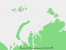 Location of McClintok Island in the Franz Josef Archipelago. | |
| Geography | |
| Location | Russian Arctic |
| Coordinates | 80°09′27″N 56°29′08″E / 80.1575°N 56.485556°E |
| Archipelago | Franz Josef Archipelago |
| Area | 612 km2 (236 sq mi) |
| Length | 33 km (20.5 mi) |
| Highest elevation | 521 m (1,709 ft) |
| Country | |
| Demographics | |
| Population | 0 |
McClintok Island or MacKlintok Island (Russian: Остров Мак-Клинтока; Ostrov Mak-Klintoka) is an island in Franz Josef Land, Russia.
This island is roughly square-shaped and its maximum length is 33 km (21 mi). Its area is 612 km2 (236 sq mi) and it is largely glaciated. Its highest point is 521 m (1,709 ft).
McClintok Island is located very close to the west of Hall Island, separated from it by a narrow sound, Proliv Negri. The island's northernmost point is Mys Grili (Greely Cape). The southwestern point is MacKlintok Island and the southeastern Mys Oppoltsera.
McClintok Island was named after Irish explorer of the Arctic Francis Leopold McClintock.
Adjacent Islands
- Ostrov Aldzher (Остров Алджер), Alger Island. Lies off McClintock Island's northern shore, separated from it by a 3 km (1.9 mi) narrow sound. Alger Island was the wintering site of the failed American Ziegler-Baldwin expedition of 1901.
- Ostrov Bryeydi (Остров Брейди), Brady Island is a relatively large island. Mostly glaciated. It is located off McClintock Island's northwestern tip, separated from it by the 6 km (3.7 mi) wide Aberdare Sound (Proliv Abyerder). The highest point on Brady Island is 381 m (1,250 ft). This island was named after 1835-1891 English chemist, pharmacist and geologist George Brady. Mys Vize, Brady Island's northernmost cape, is named after Russian Arctic expert Vladimir Wiese.
- Right by McClintock Island's southern shore, there is a group of islets called Ostrova Borisika.
- 5 km (3.1 mi) off the southern coast lies Ostrov Ogord (Остров Огорд), Aagaard Island. This island was named in honor of Andreas Zacharias Aagaard, a Norwegian merchant and consul for Austria-Hungary in Tromsø, Norway, at the time of the Austro-Hungarian North Pole Expedition.
Coordinates: 80°09′27″N 56°29′08″E / 80.1575°N 56.485556°E
See also
References
External links
- List of island names in Russian Geography]
- Pictures
- Bird life