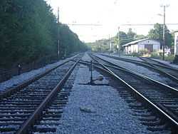
M502 railway (Croatia)
| Rijeka–Šapjane railway | ||||||||||||||||||||||||||||||||||||||||||||||||||||||||||||||||||||||||||||||||||||||||||||||||||||||||||||||||||||
|---|---|---|---|---|---|---|---|---|---|---|---|---|---|---|---|---|---|---|---|---|---|---|---|---|---|---|---|---|---|---|---|---|---|---|---|---|---|---|---|---|---|---|---|---|---|---|---|---|---|---|---|---|---|---|---|---|---|---|---|---|---|---|---|---|---|---|---|---|---|---|---|---|---|---|---|---|---|---|---|---|---|---|---|---|---|---|---|---|---|---|---|---|---|---|---|---|---|---|---|---|---|---|---|---|---|---|---|---|---|---|---|---|---|---|---|---|
| Line number: | M502 (HŽ) | |||||||||||||||||||||||||||||||||||||||||||||||||||||||||||||||||||||||||||||||||||||||||||||||||||||||||||||||||||
| Line length: | 30.9 km (19.2 mi) | |||||||||||||||||||||||||||||||||||||||||||||||||||||||||||||||||||||||||||||||||||||||||||||||||||||||||||||||||||
| Track gauge: | 1435 mm | |||||||||||||||||||||||||||||||||||||||||||||||||||||||||||||||||||||||||||||||||||||||||||||||||||||||||||||||||||
| Voltage: | 25 kV 50 Hz AC | |||||||||||||||||||||||||||||||||||||||||||||||||||||||||||||||||||||||||||||||||||||||||||||||||||||||||||||||||||
| Maximum speed: | 50 km/h (31 mph) | |||||||||||||||||||||||||||||||||||||||||||||||||||||||||||||||||||||||||||||||||||||||||||||||||||||||||||||||||||
| Route | ||||||||||||||||||||||||||||||||||||||||||||||||||||||||||||||||||||||||||||||||||||||||||||||||||||||||||||||||||||
Legend
| ||||||||||||||||||||||||||||||||||||||||||||||||||||||||||||||||||||||||||||||||||||||||||||||||||||||||||||||||||||
The Rijeka–Šapjane−State border Railway (Slovene: Pruga Rijeka−Šapjane−državna granica) is a 30.9-kilometre (19.2 mi) long, single-tracked railway line in Croatia, which is operated by HŽ Infrastruktura. M502 connects Rijeka to the Slovene railway network north of Šapjane and to the Zagreb via M202 east of Rijeka.[maps 1] It is electrified with 25 kV AC from Rijeka to Šapjane and 3kV DC from Šapjane to the national border.[1]
History
The route is opened in 1873.[2]
Gallery
Maps
- ↑ Overview map of the Rijeka−Šapjane–state border railway (Map). OpenStreetMap. Retrieved February 26, 2014.


