M2 highway (Russia)
Federal Highway M2 | |
|---|---|
| Федеральная автомобильная дорога M2 | |
| Crimea Highway | |
 | |
| Route information | |
|
Part of | |
| Length: | 720 km (450 mi) |
| Existed: | 1950 – present |
| Major junctions | |
| West end: | Ukrainian border |
| East end: | Moscow |
| Highway system | |
| Russian Federal Highways | |

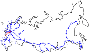
The Russian route M2 (also known as the Crimea Highway) is a major trunk road that connects Moscow to the Crimea. It is part of the European route E105. The length is 720 kilometres.
Inaugurated in 1950, the highway starts at the junction of the Moscow Ring Road and Varshavskoye Shosse and travels south-west, immediately bypassing the cities of Tula, Oryol, Kursk and Belgorod before terminating at the border with Ukraine. (Due to the accession of Crimea to the Russian Federation, is unknown at this point if the road will extend into Crimea.)
West of the border, the road continues through Kharkiv and Zaporizhia to Simferopol and Yalta as the Ukrainian M20 and M18. It is used by Russian summer vacationers who travel to the Black Sea resorts of Crimea.
| ||||||||||||||||