Mākaha, Hawaii
| Makaha, Hawaii | |
|---|---|
| Census-designated place | |
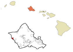 Location in Honolulu County and the state of Hawaii | |
| Coordinates: 21°28′14″N 158°12′51″W / 21.47056°N 158.21417°WCoordinates: 21°28′14″N 158°12′51″W / 21.47056°N 158.21417°W | |
| Country | United States |
| State | Hawaii |
| Area | |
| • Total | 5.2 sq mi (13.6 km2) |
| • Land | 2.3 sq mi (6.0 km2) |
| • Water | 2.9 sq mi (7.5 km2) |
| Elevation | 20 ft (6 m) |
| Population (2010) | |
| • Total | 8,278 |
| • Density | 1,600/sq mi (610/km2) |
| Time zone | Hawaii-Aleutian (UTC-10) |
| Area code(s) | 808 |
| FIPS code | 15-47450 |
| GNIS feature ID | 0362017 |
Mākaha is a census-designated place (CDP) in Honolulu County, Hawaiʻi, United States. The population was 8,278 at the 2010 census.[1]
Geography
Mākaha is located at 21°28′14″N 158°12′51″W / 21.47056°N 158.21417°W (21.470569, -158.214159).[2]
According to the United States Census Bureau, the CDP has a total area of 5.2 square miles (13 km2), of which 2.3 square miles (6.0 km2) is land and 2.9 square miles (7.5 km2), or 55.53%, is water.
Demographics
As of the census[3] of 2000, there were 7,753 people, 2,388 households, and 1,721 families residing in the CDP. The population density was 3,324.7 people per square mile (1,284.7/km²). There were 3,208 housing units at an average density of 1,375.7 per square mile (531.6/km²). The racial makeup of the CDP was 19.00% White, 1.39% African American, 0.71% Native American, 15.23% Asian, 21.90% Pacific Islander, 1.63% from other races, and 40.14% from two or more races. Hispanic or Latino of any race were 17.86% of the population.
There were 2,388 households out of which 37.8% had children under the age of 18 living with them, 44.9% were married couples living together, 19.6% had a female householder with no husband present, and 27.9% were non-families. 20.8% of all households were made up of individuals and 5.3% had someone living alone who was 65 years of age or older. The average household size was 3.20 and the average family size was 3.70.
In the CDP the population was spread out with 31.7% under the age of 18, 11.3% from 18 to 24, 26.1% from 25 to 44, 20.5% from 45 to 64, and 10.3% who were 65 years of age or older. The median age was 30 years. For every 100 females there were 98.9 males. For every 100 females age 18 and over, there were 95.1 males.
The median income for a household in the CDP was $35,674, and the median income for a family was $36,563. Males had a median income of $34,081 versus $24,606 for females. The per capita income for the CDP was $14,267. About 22.3% of families and 23.9% of the population were below the poverty line, including 32.8% of those under age 18 and 9.3% of those age 65 or over.
Education
The Hawaii Department of Education operates the public schools. Makaha Elementary School is in the CDP, while Kamaile Elementary School is outside of the CDP.[4]
References
- ↑ "Profile of General Population and Housing Characteristics: 2010 Demographic Profile Data (DP-1): Makaha CDP, Hawaii". U.S. Census Bureau, American Factfinder. Retrieved May 22, 2012.
- ↑ "US Gazetteer files: 2010, 2000, and 1990". United States Census Bureau. 2011-02-12. Retrieved 2011-04-23.
- ↑ "American FactFinder". United States Census Bureau. Retrieved 2008-01-31.
- ↑ "Makaha CDP, Hawaii." U.S. Census Bureau. Retrieved on May 21, 2009.
| ||||||
| |||||||||||||||||||||
