Mézières-en-Brenne
| Mézières-en-Brenne | ||
|---|---|---|
|
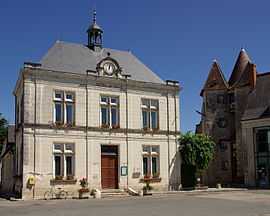
The town hall in Mézières-en-Brenne | ||
| ||
 Mézières-en-Brenne | ||
|
Location within Centre region  Mézières-en-Brenne | ||
| Coordinates: 46°49′18″N 1°12′41″E / 46.8217°N 1.2114°ECoordinates: 46°49′18″N 1°12′41″E / 46.8217°N 1.2114°E | ||
| Country | France | |
| Region | Centre-Val de Loire | |
| Department | Indre | |
| Arrondissement | Le Blanc | |
| Canton | Mézières-en-Brenne | |
| Government | ||
| • Mayor (2008–2014) | Jean-Louis Camus | |
| Area1 | 57.57 km2 (22.23 sq mi) | |
| Population (2009)2 | 1,076 | |
| • Density | 19/km2 (48/sq mi) | |
| INSEE/Postal code | 36123 / 36290 | |
| Elevation |
84–138 m (276–453 ft) (avg. 90 m or 300 ft) | |
|
1 French Land Register data, which excludes lakes, ponds, glaciers > 1 km² (0.386 sq mi or 247 acres) and river estuaries. 2 Population without double counting: residents of multiple communes (e.g., students and military personnel) only counted once. | ||
.svg.png)
Mézières-en-Brenne is a commune in the Indre department in central France.
Natural Park
It is located is at the heart of the Brenne regional natural park. The Brenne is one of France's most important wetlands. An large diversity of natural habitats is responsible for an abundance of wildlife of which the best known are the birds: purple heron, black-necked grebe, bittern, marsh harrier, whiskered tern, short-toed eagle. The Brenne is also Europe's most important site for the European pond tortoise.
Population
| Historical population | ||
|---|---|---|
| Year | Pop. | ±% |
| 1793 | 1,338 | — |
| 1800 | 1,346 | +0.6% |
| 1806 | 1,408 | +4.6% |
| 1821 | 1,454 | +3.3% |
| 1831 | 1,542 | +6.1% |
| 1836 | 1,656 | +7.4% |
| 1841 | 1,541 | −6.9% |
| 1846 | 1,598 | +3.7% |
| 1851 | 1,672 | +4.6% |
| 1856 | 1,740 | +4.1% |
| 1861 | 1,681 | −3.4% |
| 1866 | 1,824 | +8.5% |
| 1872 | 1,835 | +0.6% |
| 1876 | 1,856 | +1.1% |
| 1881 | 1,760 | −5.2% |
| 1886 | 1,818 | +3.3% |
| 1891 | 1,820 | +0.1% |
| 1896 | 1,853 | +1.8% |
| 1901 | 1,996 | +7.7% |
| 1906 | 2,000 | +0.2% |
| 1911 | 1,926 | −3.7% |
| 1921 | 1,695 | −12.0% |
| 1926 | 1,495 | −11.8% |
| 1931 | 1,423 | −4.8% |
| 1936 | 1,406 | −1.2% |
| 1946 | 1,485 | +5.6% |
| 1954 | 1,389 | −6.5% |
| 1962 | 1,312 | −5.5% |
| 1968 | 1,232 | −6.1% |
| 1975 | 1,168 | −5.2% |
| 1982 | 1,186 | +1.5% |
| 1990 | 1,194 | +0.7% |
| 1999 | 1,159 | −2.9% |
| 2009 | 1,076 | −7.2% |
See also
References
External links
| Wikimedia Commons has media related to Mézières-en-Brenne. |