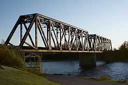
Métabetchouane River
| Metabetchouan River | |
| Rivière Métabetchouane | |
 | |
| Country | Canada |
|---|---|
| Province | Quebec |
| Regions | Capitale-Nationale, Saguenay–Lac-Saint-Jean |
| Source | Mâles and Bouteille Lakes |
| - location | Lac-Croche, Capitale-Nationale |
| - coordinates | 47°26′09″N 71°41′07″W / 47.43583°N 71.68528°W |
| Mouth | Lac Saint-Jean |
| - location | Desbiens, Saguenay–Lac-Saint-Jean |
| - elevation | 99 m (325 ft) |
| - coordinates | 48°25′15″N 71°57′55″W / 48.42083°N 71.96528°WCoordinates: 48°25′15″N 71°57′55″W / 48.42083°N 71.96528°W |
| Length | 128 km (80 mi) |
| Basin | 2,245 km2 (867 sq mi) |
| Discharge | |
| - average | 47 m3/s (1,660 cu ft/s) |
The Metabetchouan River (French: Métabetchouane) is a tributary of Lac Saint-Jean in the centre of the province of Quebec, Canada. It passes through the small town of Saint-André, and ends at Desbiens, where a cave called Le trou de la Fée is located. Its source are the Mâles and Bouteille Lakes in the Laurentides Wildlife Reserve and it is 128 kilometres (80 mi) long.[1]
The river has been dammed for hydroelectric power. Now, it is also a tourist river with rafting, canoeing, and fishing opportunities. It is known for its reserve of fresh-water salmon. In the region of Saguenay-Lac-Saint-Jean, this fish is known as Ouananiche.
Its name is of Innu origin, but also appears to be part of the Cree and Algonquin languages. From the roots matabi and djiwan, it can be translated as "river that empties into a lake".[1]
History
The mouth of the river may have been a seasonal Innu camp for thousands of years and the river itself was used as a route between Lake Saint-Jean and the Quebec City region. In 1647, Jean de Quen was the first European to visit the place but his report did not make mention of the river. Some two decades later in 1676, the first reference was made of this river as Metabeki8an in the second register of Tadoussac. That same year, Jesuits established the Saint-Charles Mission at the river's mouth. In the mid 19th century, William Price began logging along the length of the river and it was used for a long time for log driving.[1]
See also
- List of Quebec rivers
References
- ↑ 1.0 1.1 1.2 "Rivière Métabetchouane" (in French). Commission de toponymie du Québec. Retrieved 2010-11-04.