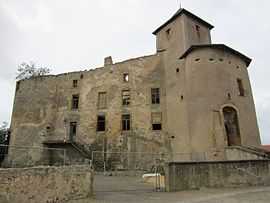
Luttange
| Luttange | ||
|---|---|---|
 | ||
| ||
 Luttange | ||
|
Location within Lorraine region  Luttange | ||
| Coordinates: 49°16′14″N 6°18′43″E / 49.2706°N 6.3119°ECoordinates: 49°16′14″N 6°18′43″E / 49.2706°N 6.3119°E | ||
| Country | France | |
| Region | Lorraine | |
| Department | Moselle | |
| Arrondissement | Thionville-Est | |
| Canton | Metzervisse | |
| Intercommunality | Communauté de communes de l'Arc mosellan | |
| Government | ||
| • Mayor (2008–2014) | Jean-Michel Werquin | |
| Area1 | 12.83 km2 (4.95 sq mi) | |
| Population (1999)2 | 752 | |
| • Density | 59/km2 (150/sq mi) | |
| INSEE/Postal code | 57426 / 57935 | |
| Elevation |
195–299 m (640–981 ft) (avg. 295 m or 968 ft) | |
|
1 French Land Register data, which excludes lakes, ponds, glaciers > 1 km² (0.386 sq mi or 247 acres) and river estuaries. 2 Population without double counting: residents of multiple communes (e.g., students and military personnel) only counted once. | ||

Luttange (Lorraine Franconian Liténgen/Léiténgen) is a commune in the Moselle department in Lorraine in north-eastern France.