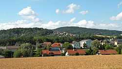
Luftenberg an der Donau
| Luftenberg an der Donau | ||
|---|---|---|
 | ||
| ||
 Luftenberg an der Donau Location within Austria | ||
| Coordinates: 48°16′32″N 14°25′45″E / 48.27556°N 14.42917°ECoordinates: 48°16′32″N 14°25′45″E / 48.27556°N 14.42917°E | ||
| Country | Austria | |
| State | Upper Austria | |
| District | Perg | |
| Government | ||
| • Mayor | Karl Buchberger (SPÖ) | |
| Area | ||
| • Total | 16.9 km2 (6.5 sq mi) | |
| Elevation | 295 m (968 ft) | |
| Population (1 January 2014)[1] | ||
| • Total | 3,980 | |
| • Density | 240/km2 (610/sq mi) | |
| Time zone | CET (UTC+1) | |
| • Summer (DST) | CEST (UTC+2) | |
| Postal code | 4225 | |
| Area code | 07237 | |
| Vehicle registration | PE | |
| Website | www.luftenberg.at | |
Luftenberg an der Donau is a municipality and small market town in the district of Perg in the Austrian state of Upper Austria. As of 2013, the town had 3,856 inhabitants.
Population
| Historical population | ||
|---|---|---|
| Year | Pop. | ±% |
| 1869 | 1,101 | — |
| 1880 | 1,142 | +3.7% |
| 1890 | 1,072 | −6.1% |
| 1900 | 1,082 | +0.9% |
| 1910 | 1,133 | +4.7% |
| 1923 | 1,174 | +3.6% |
| 1934 | 1,190 | +1.4% |
| 1939 | 1,205 | +1.3% |
| 1951 | 1,255 | +4.1% |
| 1961 | 1,615 | +28.7% |
| 1971 | 2,543 | +57.5% |
| 1981 | 3,079 | +21.1% |
| 1991 | 3,283 | +6.6% |
| 2001 | 3,665 | +11.6% |
| 2010 | 3,848 | +5.0% |
| 2013 | 3,856 | +0.2% |
References
| Wikimedia Commons has media related to Luftenberg an der Donau. |
