Lučine
| Lučine | |
|---|---|
|
Lučine | |
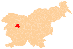
_location_map.svg.png) Lučine Location in Slovenia | |
| Coordinates: 46°3′42.11″N 14°11′47.18″E / 46.0616972°N 14.1964389°ECoordinates: 46°3′42.11″N 14°11′47.18″E / 46.0616972°N 14.1964389°E | |
| Country |
|
| Traditional region | Upper Carniola |
| Statistical region | Upper Carniola |
| Municipality | Gorenja Vas–Poljane |
| Area | |
| • Total | 2.34 km2 (0.90 sq mi) |
| Elevation | 634 m (2,080 ft) |
| Population (2002) | |
| • Total | 160 |
| [1] | |
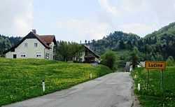
Lučine (in older sources also Lučna,[2] German: Lutschna[2]) is a village in the hills south of Gorenja Vas in the Municipality of Gorenja Vas–Poljane in the Upper Carniola region of Slovenia.[3]
Name
Lučine was first attested in written sources as Lutschen in 1291 and Lutsschen in 1318. The name Lučine, like similar toponyms (e.g., Luče, Leutschach < Lučane), is derived from the Slavic personal name *Ľubъkъ and likely refers to an early inhabitant of the place.[4] In the 19th century the German name was Lutschna.[2]
Church

The local church is dedicated to Saint Vitus (Slovene: sveti Vid) and stands in the eastern part of the settlement in the middle of a cemetery. The original Late Gothic church was extended and a belfry was added in 1669. In 1898 the old church, apart from the belfry, was demolished to make way for an entirely new building.[5] The current church has a rectangular nave with side chapels and an octagonal presbytery walled on three sides. The church was designed by Anton Jeblinger in 1897 and the stonework was executed by Peter Bevk from 1898 to 1899.[6]
References
- ↑ Statistical Office of the Republic of Slovenia
- ↑ 2.0 2.1 2.2 Leksikon občin kraljestev in dežel zastopanih v državnem zboru, vol. 6: Kranjsko. 1906. Vienna: C. Kr. Dvorna in Državna Tiskarna, p. 64. (Slovene)
- ↑ Gorenja Vas–Poljane municipal site
- ↑ Snoj, Marko. 2009. Etimološki slovar slovenskih zemljepisnih imen. Ljubljana: Modrijan and Založba ZRC, p. 247.
- ↑ Cultural Heritage in the Municipality of Gorenja Vas–Poljane (Slovene)
- ↑ Slovenian Ministry of Culture register of national heritage reference number ešd 2012
External links
| ||||||||||||||||