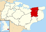
Lower Hardres
| Lower Hardres | |
 Lower Hardres |
|
| Area | 9.14 km2 (3.53 sq mi) |
|---|---|
| Population | 570 (Civil Parish)[1] |
| – density | 62/km2 (160/sq mi) |
| OS grid reference | TR150530 |
| Civil parish | Lower Hardres |
| District | City of Canterbury |
| Shire county | Kent |
| Region | South East |
| Country | England |
| Sovereign state | United Kingdom |
| Post town | CANTERBURY |
| Postcode district | CT4 |
| Dialling code | 01227 |
| Police | Kent |
| Fire | Kent |
| Ambulance | South East Coast |
| EU Parliament | South East England |
| UK Parliament | Canterbury |
Coordinates: 51°14′10″N 1°04′48″E / 51.236°N 1.080°E
Lower Hardres is a village and civil parish near Canterbury in Kent, South East England.
The name of the Hardres family is perpetuated in the twin villages of Upper Hardres and Lower Hardres (pronounced 'hards'), on the Roman road, Stone Street, south-west of the city of Canterbury. The family owned the non-church land of area for 700 years after the Norman Conquest.[2]
A legal record in 1381 mentions William Sely, parson of "parva Ardres", & may indicate that a bell at Lower Hardres church was being made or repaired by John Bukyngham. A debt of 45 marks is mentioned. [3]
References
- ↑ Key Statistics; Quick Statistics: Population Density United Kingdom Census 2011 Office for National Statistics Retrieved 21 November 2013
- ↑ Canterbury City Council
- ↑ National Archives; CP 40/483; http://aalt.law.uh.edu/AALT6/R2/CP40no483/483_0080.htm, second entry; John Buckingham, is a "clarioner"; year 1381
External links
![]() Media related to Lower Hardres at Wikimedia Commons
Media related to Lower Hardres at Wikimedia Commons
