Loutrochori, Pella
| Loutrochori Λουτροχώρι | |
|---|---|
|
Panoramic view of Loutrochori in May 2004. | |
 Loutrochori | |
|
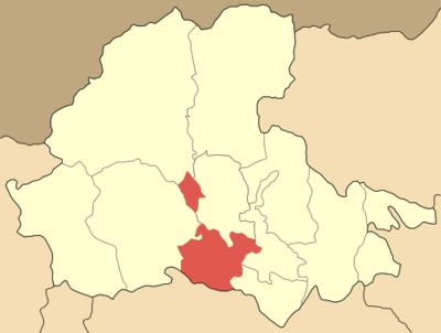
Location within the region | |
| Coordinates: 40°43′N 22°06′E / 40.717°N 22.100°ECoordinates: 40°43′N 22°06′E / 40.717°N 22.100°E | |
| Country | Greece |
| Administrative region | Central Macedonia |
| Regional unit | Pella |
| Municipality | Skydra |
| Municipal unit | Skydra |
| Area | |
| • Rural | 7.506 km2 (2.898 sq mi) |
| Highest elevation | 90 m (300 ft) |
| Lowest elevation | 59 m (194 ft) |
| Population (2001)[1] | |
| • Rural | 458 |
| • Rural density | 61/km2 (160/sq mi) |
| Time zone | EET (UTC+2) |
| • Summer (DST) | EEST (UTC+3) |
| Postal code | 585 00 |
| Area code(s) | 23810 |
| Vehicle registration | ΕΕ |
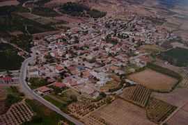
Loutrochori(on) (Greek: Λουτροχώρι(οv) meaning "bath town"; formerly Paina, Πάινα and Bania, Μπάνια meaning "baths")[2] is a village in the Pella regional unit, of Macedonia in Greece. According to the 2001 census, it has a population of 458[3], its area is 7.506 km2, and its population density is 62.08 per km2. The village is on a hill and thus it has a view of the surrounding countryside.
Loutrochori is situated 30 kilometres (19 miles) north of the Egnatia Highway (or A2, the Greek part of the E90) and 10 km (6 mi) south of the EO2 (or E 86). The nearest railroad (train) stations, on the OSE's Thessaloniki–Bitola railway, are 3 km (2 mi) east (Petrea), 8 km (5 mi) southeast (Episkopi) and 9 km (6 mi) northeast (Skydra). The Loutrochori area was famous from ancient times for its spa. The spa (iamatica loutra, ιαματικά λουτρά) of Loutrochori (spa-drinking therapy)[4] is situated just 0.5 km (0.3 mi) away near the local mountain of Canber (358 m or 1,175 ft).
History
Ancient era
The Loutrochori area has been a spa from the 4th century BC under the Macedonian Kingdom.
Modern era
Modern Loutrochori is a relatively new village; it was founded in the 1920s by the first Greek refugees from Pontus, under the name "Μπάνια" (Bania).[2] After the Greek Genocide and the Greco-Turkish War (1919-1922), a large number of Pontic Greek refugees arrived at the village as a result of the population exchange under the Treaty of Lausanne. In 1926, the village's name was changed to "Λουτροχώρι" (Loutrochori).[2]
Demographics
| Historical population (Statistics, 1913-2001) | |
| Census | Population |
|---|---|
| 1913 [5] | 23 |
| 1920 [6] | 56 |
| 1928 [7] | 165 |
| 1940 [8] | 323 |
| 1951 [9] | 367 |
| 1961 [10] | 435 |
| 1971 [11] | 391 |
| 1981 [12] | 739 |
| 1991 [13] | 483 |
| 2001 [14] | 466 |
| 2011 [3] | 458 |
| *Estimate. | |
The village's population grew rapidly after 1923. After the Second World War and the Greek Civil War, the population steadily declined as residents moved to larger towns and cities or emigrated.
The inhabitants are (100%) ethnic Greeks and Greek Orthodox Christians.
Geography
Loutrochori is the southwestern part of the municipality of Skydra. It is 21 kilometres (13 miles) southeast of the regional unit capital of Edessa in Central part of Macedonia in Greece. Loutrochori is bounded by the Imathia to the southwest and it is 28 kilometres (17 miles) northwest of the Imathian capital Veria. It sits at an elevation of around 90 metres (295 feet) above mean sea level and the population is approximately from 500 (in winter) to 800 (in summer) inhabitants.
Loutrochori covers an area of some 7.506 km2 (2.898 sq mi), between the mountains Vermio (2,052 m or 6,732 ft) to the southwest, Voras (2,524 m or 8,281 ft) to the northwest and Paiko (1,650 m or 5,410 ft) to the northeast.
Loutrochori is located at a distance of 533 kilometres (331 miles) northwest of the present day Greek capital - Athens by road, 44 km (27 miles) north of the royal capital of ancient Macedon - Vergina, 40 km (25 miles) west of the first capital of the Greek Macedonian Kingdom and birthplace of Alexander the Great - Pella and 82 km (51 miles) northwest of Thessaloniki, the present-day capital of Greek Macedonia.
Locations and distance
Climate
| Loutrochori, Pella | ||||||||||||||||||||||||||||||||||||||||||||||||||||||||||||
|---|---|---|---|---|---|---|---|---|---|---|---|---|---|---|---|---|---|---|---|---|---|---|---|---|---|---|---|---|---|---|---|---|---|---|---|---|---|---|---|---|---|---|---|---|---|---|---|---|---|---|---|---|---|---|---|---|---|---|---|---|
| Climate chart (explanation) | ||||||||||||||||||||||||||||||||||||||||||||||||||||||||||||
| ||||||||||||||||||||||||||||||||||||||||||||||||||||||||||||
| ||||||||||||||||||||||||||||||||||||||||||||||||||||||||||||
The average temperature is 14.8 degrees Celsius and the average rainfall about 470 millimetres per year.
Loutrochori has a Mediterranean climate with mild, rainy winters and hot, dry summers. The warmest month is August, with 18 to 32 °C (64 to 90 °F). Record high temperatures of up to 42 °C (108 °F). The coolest month is January, averaging 1 to 7 °C (34 to 45 °F).
Economy
Loutrochori produces cherries, apples, some strawberries and peaches.
Gallery
Churches and Chapels in Loutrochori
-
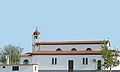
Agii Pandes (All Saints) Greek Orthodox Church in Loutrochori.
-
Agios Georgios (Saint George) Greek (Byzantine) Orthodox country Church in Loutrochori.
-

Analipseos Tou Kiriou (Ascension of Jesus) Greek Orthodox Chapel in Loutrochori.
-

Profitis Ilias (Prophet Elias) Greek Orthodox Church in Loutrochori.
References
- ↑ De Facto Population of Greece Population and Housing Census of March 18th, 2001 (PDF 39 MB). National Statistical Service of Greece. 2003.
- ↑ 2.0 2.1 2.2 Pandektis: Name Changes of Settlements in Greece, Retrieved on April 2, 2009, compiled by the Institute for Neohellenic Research
- ↑ 3.0 3.1 (Greek) 2011 Census, National Statistical Service of Greece (ΕΣΥΕ), (Απογραφή 2011 (μόνιμος πληθυσμός)
- ↑ (Greek) Ιαματική Πηγή Λουτροχωρίου (Δήμος Σκύδρας), History and Information about the baths of Loutrochori
- ↑ (Greek) 1913 Census, National Statistical Service of Greece (ΕΣΥΕ), (Απογραφή 1913 (πληθυσμός των νέων χωρών) - Σελ. 16
- ↑ (Greek) 1920 Census, National Statistical Service of Greece (ΕΣΥΕ), (Απογραφή 1920 (πραγματικός πληθυσμός) - Σελ. 244
- ↑ (Greek) 1928 Census, National Statistical Service of Greece (ΕΣΥΕ), (Απογραφή 1928 (πραγματικός πληθυσμός) - Σελ. 286
- ↑ (Greek) 1940 Census, National Statistical Service of Greece (ΕΣΥΕ), (Απογραφή 1940 (πραγματικός πληθυσμός) - Σελ. 316
- ↑ (Greek) 1951 Census, National Statistical Service of Greece (ΕΣΥΕ), (Απογραφή 1951 (πραγματικός πληθυσμός) - Σελ. 155
- ↑ (Greek) 1961 Census, National Statistical Service of Greece (ΕΣΥΕ), (Απογραφή 1961 (πραγματικός πληθυσμός) - Σελ. 149
- ↑ (Greek) 1971 Census, National Statistical Service of Greece (ΕΣΥΕ), (Απογραφή 1971 (πραγματικός πληθυσμός) - Σελ. 147
- ↑ (Greek) 1981 Census, National Statistical Service of Greece (ΕΣΥΕ), (Απογραφή 1981 (πραγματικός πληθυσμός) - Σελ. 155
- ↑ (Greek) 1991 Census, National Statistical Service of Greece (ΕΣΥΕ), (Απογραφή 1991 (πραγματικός πληθυσμός) - Σελ. 190
- ↑ (Greek) 2001 Census, National Statistical Service of Greece (ΕΣΥΕ), (Απογραφή 2001 (πραγματικός πληθυσμός) - Σελ. 191
External links
- Loutrochori on GTP Travel Pages (Community)
- Loutrochórion (Pélla, Macedonia, Greece)
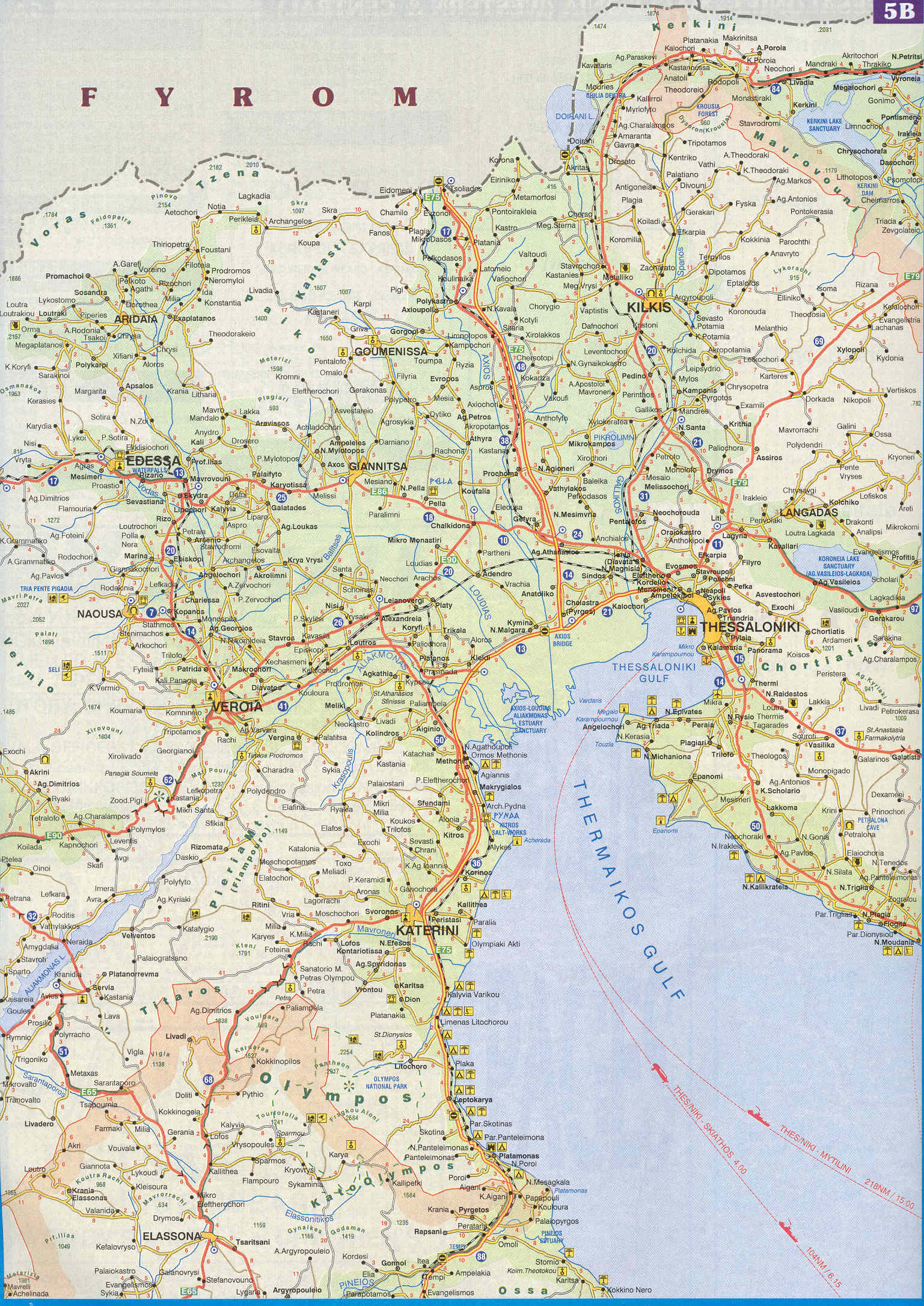
- Map of Central Macedonia. - Loutrochori NW (20)
- (Greek) A blog about Loutrochori
- (Greek) Primary school of Loutrochori
- (Greek) Kindergarten of Loutrochori
- (Greek) Loutrochori (epigraphy, Delacoulonche 242,24)
 |
Kesariana, Platani | Sevastiana, Rizari | Rizo, Skydra | |
| Polla Nera, Agia Foteini | |
Petrea, Arseni | ||
| ||||
| | ||||
| Gianakochori, Rodochori | Marina, Lefkadia | Plevroma, Episkopi |
| ||||||||||