Louisiana Highway 19
| ||||
|---|---|---|---|---|
 | ||||
| Route information | ||||
| Maintained by Louisiana DOTD | ||||
| Length: | 34.0 mi[1] (54.7 km) | |||
| Existed: | 1955 renumbering – present | |||
| Major junctions | ||||
| South end: |
| |||
|
| ||||
| North end: |
| |||
| Highway system | ||||
| ||||

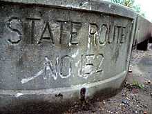
Louisiana Highway 19 (LA 19) is a state highway in Louisiana which serves the parishes of East Baton Rouge and East Feliciana. It spans 34 miles (55 km), beginning in Baton Rouge and ending at the Louisiana/Mississippi state line. Before the 1955 renumbering, it was known as Louisiana State Route 91 until Slaughter, then State Route 152 until the current terminus at US 61/Old State Route 3.
Route description
LA 19 begins at a junction with U.S. Route 61 north of Baton Rouge and heads nearly due north where it intersects Interstate 110. After leaving the Baton Rouge city limits, LA 19 passes through Baker, serving as the western terminus of LA 3006, then heads north to Zachary. From Zachary, LA 19 continues north-northeastward into East Feliciana Parish.
In East Feliciana Parish, LA 19 intersects LA 412 in Slaughter. LA 19 also intersects LA 10 and LA 956 in rural parts of the parish. In Wilson, LA 19 intersects LA 68, and in Norwood, LA 19 acts as the western terminus for LA 422. At the state line, LA 19 ends and becomes Mississippi Highway 33 in Mississippi.
References
- ↑ Google (December 24, 2014). "Louisiana Highway 19" (Map). Google Maps. Google. Retrieved December 24, 2014.