Loughborough Lake
| Loughborough Lake | |
|---|---|
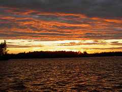
 at Sunset | |
| Location | Ontario |
| Coordinates | 44°27′N 76°25′W / 44.450°N 76.417°WCoordinates: 44°27′N 76°25′W / 44.450°N 76.417°W |
| Lake type | freshwater |
| Primary inflows | Heart Cr, Milburn Cr. |
| Basin countries | Canada |
| Max. length | 24 km |
| Max. width | varies |
| Surface area | 18 km² |
| Average depth | 14.4 m |
| Max. depth | 38.4 m |
| Shore length1 | 160 km |
| Surface elevation | 124.3 m |
| Islands | Big Is, Plumb Is, Horseshoe Is, Griffiths Is, Loon Is, Whitefish Is. |
| Settlements | Battersea, Ontario |
| 1 Shore length is not a well-defined measure. | |
Loughborough Lake is a lake in Ontario, Canada and is located 20 kilometres (12 mi) north of Kingston, Ontario; it is 24 kilometres (15 mi) long and 15 square kilometres (5.8 sq mi) in area, with many small islands, and has over 160 kilometres (99 mi) of shoreline.
In shallow areas of the lake (10 metres (33 ft) and shallower), large mouth and smallmouth bass, northern pike and various other pan fish are found; deeper areas contain largemouth and smallmouth bass, northern pike, lake trout, rainbow trout and pan fish. The lake was once stocked.
The east basin of Loughborough Lake contains several islands, and is shallow compared to the west basin.
The village of Battersea, Ontario is located on the south shore of the lake's east basin.
Davidson's Beach is located on the lower end of the Lake; on its east shoreline.