Loring International Airport
| Loring International Airport | |||||||||||
|---|---|---|---|---|---|---|---|---|---|---|---|
|
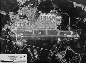
1970 aerial photograph of Loring Air Force Base | |||||||||||
| IATA: LIZ – ICAO: none – FAA LID: ME16 | |||||||||||
| Summary | |||||||||||
| Airport type | Public | ||||||||||
| Owner | Loring Development Authority | ||||||||||
| Location | Limestone, Maine | ||||||||||
| In use | 1997-Present | ||||||||||
| Elevation AMSL | 745 ft / 227 m | ||||||||||
| Coordinates | 46°57′00″N 67°53′00″W / 46.95000°N 67.88333°W | ||||||||||
| Website | http://loring.org/ | ||||||||||
| Runways | |||||||||||
| |||||||||||
Loring International Airport is the operational name of the airfield at the former Loring Air Force Base in Limestone, Maine. It is currently operated by the Loring Commerce Centre. The airfield itself sits on 1,600 acres of land, and is kept in good condition.[1]
References
- ↑ "Loring Aviation Complex". Aroostook Partnership for Success. Retrieved 2 February 2013.
External links
- Airport information for ME16 at AirNav