Lorentz, West Virginia
| Lorentz, West Virginia | |
|---|---|
| Unincorporated community | |
 Lorentz, West Virginia | |
| Coordinates: 39°00′39″N 80°18′08″W / 39.01083°N 80.30222°WCoordinates: 39°00′39″N 80°18′08″W / 39.01083°N 80.30222°W | |
| Country | United States |
| State | West Virginia |
| County | Upshur |
| Elevation | 1,447 ft (441 m) |
| Time zone | Eastern (EST) (UTC-5) |
| • Summer (DST) | EDT (UTC-4) |
| ZIP code | 26229 |
| Area code(s) | 304 & 681 |
| GNIS feature ID | 1542457[1] |
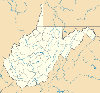
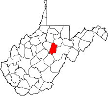
Lorentz is an unincorporated community in Upshur County, West Virginia, United States. Lorentz is located on U.S. Route 33 and U.S. Route 119 4 miles (6.4 km) west-northwest of Buckhannon. Lorentz has a post office with ZIP code 26229.[2]
Climate
The climate in this area is characterized by relatively high temperatures and evenly distributed precipitation throughout the year. According to the Köppen Climate Classification system, Lorentz has a Humid subtropical climate, abbreviated "Cfa" on climate maps.[3]
| Climate data for Lorentz, West Virginia | |||||||||||||
|---|---|---|---|---|---|---|---|---|---|---|---|---|---|
| Month | Jan | Feb | Mar | Apr | May | Jun | Jul | Aug | Sep | Oct | Nov | Dec | Year |
| Average high °C (°F) | 6 (42) |
7 (44) |
12 (53) |
18 (64) |
23 (74) |
27 (80) |
28 (83) |
28 (82) |
25 (77) |
19 (66) |
12 (54) |
7 (44) |
17.7 (63.6) |
| Average low °C (°F) | −6 (22) |
−6 (22) |
−1 (30) |
3 (38) |
9 (48) |
13 (56) |
16 (60) |
14 (58) |
11 (52) |
4 (40) |
−1 (31) |
−4 (24) |
4.3 (40.1) |
| Average precipitation cm (inches) | 10 (4) |
8.9 (3.5) |
10.9 (4.3) |
10 (4) |
11.9 (4.7) |
13 (5.1) |
13.5 (5.3) |
11.2 (4.4) |
9.1 (3.6) |
8.6 (3.4) |
8.6 (3.4) |
9.9 (3.9) |
125.6 (49.6) |
| Source: Weatherbase [4] | |||||||||||||
References
- ↑ "US Board on Geographic Names". United States Geological Survey. 2007-10-25. Retrieved 2008-01-31.
- ↑ ZIP Code Lookup
- ↑ Climate Summary for Lorentz, West Virginia
- ↑ "Weatherbase.com". Weatherbase. 2013. Retrieved on September 15, 2013.
| |||||||||||||||||||||||||
