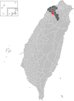
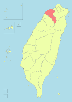
Longtan District, Taoyuan
| Longtan 龍潭區 | |
|---|---|
| District | |
| Longtan District | |
|
Longtan Lake | |
 | |
| Coordinates: 24°50′40″N 121°12′19″E / 24.84444°N 121.20528°E | |
| Country |
|
| Region | Northern Taiwan |
| Government | |
| • Mayor | Yu-tsai, Deng |
| Area | |
| • Total | 75.2341 km2 (29.0480 sq mi) |
| Population (December 2014) | |
| • Total | 116,211 |
| • Density | 1,500/km2 (4,000/sq mi) |
| Website | http://www.longtan.gov.tw/ |

Longtan District (Chinese: 龍潭區; pinyin: Lóngtán Qū) is a rural district in southern Taoyuan City, Taiwan. Longtan is home to the headquarters of the Republic of China Army.
The township is known for the Buddhist temple in the center of Longtan Lake and the large Bainien community project. The area is surrounded by high-tech industries and mountains.
Longtan is home to a number of military bases, and a few research installations. Chungshan Institute of Science and Technology and Institute of Nuclear Energy Research[1] are two of the more well known ones.
History
Longtan used to be a rural township of the former Taoyuan County. On 25 December 2014, it was upgraded into a district of Taoyuan City.
Geography
- Area: 75.23 km²
- Population: 116,211 people (December 2014)
Administrative divisions
Huangtang Village, Yongxing Village, Zhongshan Village, Wushulin Village, Wulin Village, Bonian Village, Lingyun Village, Longxiang Village, Bade Village, Shengde Village, Shanglin Village, Longtan Vil. Longxing Village, Zhongzheng Village, Shanghua Village, Jiulong Village, Wuhan Village, Tungxing Village, Zhongxing Village, Beixing Village, Jiaan Village, Sankeng Village, Daping Village, Sanlin Village, Jianlin Village, Fulin Village, Gaoping Village, Gaoyuan Village, Sanhe Village, Sanshui Village.[2]
Education
Tourist attractions
- Shihmen Reservoir
- Taoyuan Hakka Culture Hall
- Window on China Theme Park
Transportation
Longtan is served by National Highway No. 3.
See also
| Wikimedia Commons has media related to Longtan, Taoyuan. |
References
External links
| Wikivoyage has a travel guide for Longtan. |
| |||||||||||||||||
Coordinates: 24°50′40″N 121°12′19″E / 24.84444°N 121.20528°E