Long Branch, Panola County, Texas
| Long Branch, Texas | |
|---|---|
| unincorporated community | |
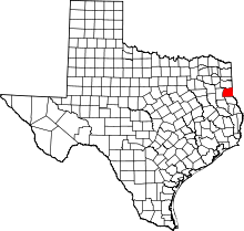
 Location of Long Branch in Texas | |
| Coordinates: 32°04′23″N 94°34′05″W / 32.07306°N 94.56806°WCoordinates: 32°04′23″N 94°34′05″W / 32.07306°N 94.56806°W | |
| Country | United States |
| State | Texas |
| County | Panola |
| Elevation[1] | 371 ft (113 m) |
| Time zone | Central (CST) (UTC-6) |
| • Summer (DST) | CDT (UTC-5) |
| ZIP code | 75669 |
| Area code(s) | 903 |
| FIPS code | 48-48365 |
| GNIS feature ID | 1378605[1] |
| [2] | |
Long Branch is an unincorporated community in Panola County, Texas, United States. According to the Handbook of Texas, the community had an estimated population of 181 in 2000.[3]
Geography
Long Branch is located at 32°04′23″N 94°34′05″W / 32.072942°N 94.567984°W (32.072942, -94.567984).[1] It is situated along FM 348 in southwestern Panola County, approximately 14 miles southwest of Carthage.[3]
Long Branch lies 371 feet (113 m) above sea level.
Education
Public education in the community of Long Branch is provided by the Carthage Independent School District.
References
- ↑ 1.0 1.1 1.2 U.S. Geological Survey Geographic Names Information System: Long Branch, Texas. Retrieved on 2008-07-02.
- ↑ "ZIP Code Lookup". Retrieved 2008-07-02.
- ↑ 3.0 3.1 "Long Branch, Texas". The Handbook of Texas online. Retrieved 2009-11-01.
| |||||||||||||||||||||||||||||